|
Author
[Stockdale, John (1749-1814), Neele, Samuel John, 1758-1824, Chauchard, Captain Jean Baptiste Hippolyte]
Full Title
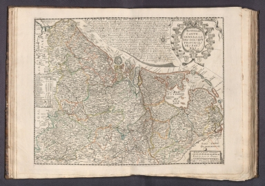
I A General Map of The Empire of Germany, Holland, The Netherlands, Switzerland, The Grisons, Italy, Sicily, Corsica, and Sardinia.
List No
15800.039
Note
Dimensions are sheet sizes.
Author
[Stockdale, John (1749-1814), Neele, Samuel John, 1758-1824, Chauchard, Captain Jean Baptiste Hippolyte]
Full Title
II A General Map of The Empire of Germany, Holland, The Netherlands, Switzerland, The Grisons, Italy, Sicily, Corsica, and Sardinia.
List No
15800.040
Note
Dimensions are sheet sizes.
Author
[Stockdale, John (1749-1814), Neele, Samuel John, 1758-1824, Chauchard, Captain Jean Baptiste Hippolyte]
Full Title
III A General Map of The Empire of Germany, Holland, The Netherlands, Switzerland, The Grisons, Italy, Sicily, Corsica, and Sardinia.
List No
15800.041
Note
Dimensions are sheet sizes.
Author
[Stockdale, John (1749-1814), Neele, Samuel John, 1758-1824, Chauchard, Captain Jean Baptiste Hippolyte]
Full Title
(Title to) XXIII A General Map of The Empire of Germany, Holland, The Netherlands, Switzerland, The Grisons, Italy, Sicily, Corsica, and Sardinia.
List No
15800.061
Note
Dimensions are sheet sizes.
Author
[Ravenstein, August, Berlin Geographisch-Artistische Anstalt Ernst Schotte]
Full Title
Karten-Ideal zur elementaren Darstellung der topischen Verhältnisse von Wasser und Land auf dem Erdboden, nebst der Oestl. & Westl. Erdhälfte, zur Erläuterung mathemat. eintheilung u. physisch-geograph. Verhältnisse. Zeichnung u. Modell von August Ravenstein in Frankfurt a. M. Stich, Prägung, Druck u. Verlag von B. Dondorf in Frankfurt a. M.
List No
14473.003
Note
Relief map of the world, shown as the Western and Eastern Hemispheres, as well as a closer view of the Netherlands and vicinity. Shows geographical regions, topography, vegetation, bodies of water, drainage, coastlines, shoals and islands. Topography shown with raised relief. Includes latitudinal and longitudinal lines, as well as descriptive notes. Legend for map appears on title page. Colored lithograph. Map is 22 x 27 cm, within frame 24 x 28 cm. Within a series of eight maps comprising the school atlas, Plastischer Schul-Atlas.
Author
[Ravenstein, August, Berlin Geographisch-Artistische Anstalt Ernst Schotte]
Full Title
Deutschland nebst den Königreichen Holland, Belgien und der Republik Schweiz. Zeichnung u. Modell von August Ravenstein in Frankfurt a. M. Stich, Prägung, Druck u. Verlag von B. Dondorf in Frankfurt a. M.
List No
14473.004
Note
Relief map of Germany, the Netherlands, Belgium and Switzerland. Shows geographical regions, countries, cities, railways, canals, topography, vegetation, bodies of water, drainage, coastlines, shoals and islands. Topography shown with raised relief. Includes a legend, bar scale given in miles, latitudinal and longitudinal lines, as well as statistical and descriptive notes. Additional legend for map appears on title page. Colored lithograph. Map is 22 x 27 cm, within frame 24 x 28 cm. Within a series of eight maps comprising the school atlas, Plastischer Schul-Atlas.
Author
Jollain, Gerhard
Full Title
Nouvelle Carte Generalle Des Dix Sept Provinces
List No
15185.021
Author
Lagniet
Full Title
Carte des Provinces Unies des Pays Bas connues soubs le nom de Hollande et pays circonvoisins ou l'on voitee qu'elles ont possede depuis leur Union a Utrecht l'an 1579 jusques a l'annee 1672 que la France a reduit en partie a son obeissace …
List No
15185.022
Author
Greenleaf, Jeremiah
Full Title
Belgium And Holland.
List No
15176.014
Note
Full color by country. Engraved. Relief shown by hachures. In full color by country. Five scales. Meridians Greenwich and Washington.
Author
Hossein
Full Title
(Political map of the Northwestern Europe). جغرافیای عمومی اطلسی = Atlas of general geography. Istanbul 1300 (1923).
List No
13686.005
Note
Color political map of Netherlands, Belgium and Luxembourg.
Author
Burr, David H., 1803-1875
Full Title
The Kingdom of the Netherlands. Drawn and published by David H. Burr. New-York.
List No
14341.006
Note
Map of the Nethlands and vicinity. Shows political boundaries, cities, roads, canals, topography, vegetation, drainage, shorelines and islands. Relief shown with hachures. Includes five bar scales, given in Dutch and German miles, Flemish miles, French leagues, French post leagues and British miles, as well as latitudinal and longitudinal lines. Hand-colored engraving. Map is 32 x 25 cm, on sheet 43 x 35 cm. "Entered according to act of Congress, Novr. 11th in the year 1831 by David H. Burr, in the Clerk's office of the District Court for the Southern District of New-York."
Author
شكوفه مقبل [Şukufe Mukbil]
Full Title
(Benelux)
List No
10992.019
Note
Dimensions are sheet size.
Author
[Koch, Wilhelm, Opitz, C.]
Full Title
Deutsches Reich. Section 6. Eisenbahn und verkehrsatlas von Europa. Section 6.
List No
13679.015
Note
Railways and traffic map of Germany, with inset map. Prime meridian: Greenwich. Shows boundaries. Includes list of German states and private railways and Dutch railways.
Author
[Ferraris, Josef Johan, Graf, 1726-1814, Vandermaelen, Philippe, 1795-1869]
Full Title
Carte de la Belgique, d'apres Ferraris. Middelbourg. Etablissement geographique de Bruxelles. Executes depuis 1777 jusqu'en 1831.
List No
13325.003
Author
Homann, Johann Baptist, 1663-1724
Full Title
Wasser Flutt in Nieder Teutschland. (inset) Nord Holland.
List No
12499.152
Note
Shows results of a terrible flood in 1717 on the coast of the Netherlands, near Bremen, Germany.
Author
[Covens et Mortier, Colom, Jacob Aertsz, 1599-1673]
Full Title
Sheet 39, 40. Carte Nouvelle De La Comté De Hollande Et De La Seigneurie D'utrecht = Comitatus Hollandiæ Et Dominii Ultraiectini Tabula : Ou sont Exactement Marquée toutes les Villes, Villages, Haimaux, Les Costes de la Mer les Bancs, les Isles, les Lac, Rivieres, Canaux, Chemins, Montagnes, Bois, et Generalement tout ce qui s'y trouve, Levée sur le Lieu en Grand Point Gravée en Quarante Planches; qu'on peut Coller dans une Carte de 11 Pied de Largeur et 6 Pied de Hauteur.
List No
10154.020
Note
Date 1 map on 40 sheets bound in volume : hand-coloured, copplerplate engraving ; 40.5 x 30.5 cm (each plate) Includes cartouche with title in Latin decorated with garlands of fruit and male and female figures holding drapery, cartouche with scale bars, cartouche with title and production details in French flanked by figures of fisherman and peasant under coat of arms, military trophies and symbols of agriculture and navigation and coat of arms held by triton and nymph (?). Copy after map published by Jacob Aertsz. Colom in 1639. When mounted together the 40 sheets form a map measuring approximately 162 x 299 cm. For another copy cut and partially mounted kept within case see Maps C.24.c.23. Titled 'Carte nouvelle de la Comté de Hollande, et de la Seigneurie d'Utrecht, chez Covens et Mortier, en 40 planches. Fol.' in the Catalogue of Maps, Prints, Drawings, etc., forming the geographical and topographical collection attached to the Library of his late Majesty King George the third, etc., London, 1829.
Author
Fer, Nicolas de, 1646-1720
Full Title
Anvers Antwerpen en flamand belle et grande ville des Pais Bas ... A Paris. Chez le Sr. De Fer. H. Van Loon. Sculp. 1e. Partie. (to accompany) Les forces de l'Europe ... Le tout recueilli par les soins du Sr. de Fer ... Premiere partie. A Paris, chez l'Auteur dans l'Isle du palais. M. DC. LXXXXIII (1693).
List No
11668.022
Note
Engraved plan of Antwerp with its fortifications. Shows rivers, canals, settlements and place names. Includes key to the important sites on the map and notes.
Author
[Berghaus, Heinrich, Berghaus, Hermann, Schmidt, C., Risch, M.]
Full Title
Tieflander. Entw. v. Herm. Berghaus 1883, Ausg. 1887. Gez. v. C. Schmidt u. M. Risch. Gotha: Justus Perthes. (On upper margin) I. Abt. Geologie No. II. Berghaus' physikal atlas No. 2. (to Accompany) Berghaus' Physikalischer Atlas. (Begrundet 1836 durch Heinrich Berghaus) ... Gotha: Justus Perthes. 1892.
List No
4391.013
Note
14 color lithograph maps with insets on 1 sheet. Includes: Die Heutigen Niederlande, with insets: Niederlande in 1. Jahrhundert -- Niederlande in X. Jahrhundert, at scale of 1: 6,000,000. Fen District -- El-Ghor oder das Jordan Thal -- Kaspisches Tiefland und Manytsch Niederrung -- Natron-Seen -- El Fajum -- Nordrand der Libyschen Wuste -- Das Todte Thal -- Colorado-Wuste -- Nordrand der Algerischen Sahara -- Goban n. Paulistischke -- Sud-Australische Seen -- Tiefland Asale -- Assal-See. Relief shown by contours and spot heights. Depth shown by gradient tints and soundings. Prime meridian is Greenwich.
Author
Keere, Pieter van den, 1571-approximately 1646
Full Title
Leo Belgicus.
List No
12070.019
Author
[Brockhaus, F.A., Leeder, Ehrenfried, Leutemann, Heinrich]
Full Title
Niederlande und Belgien.
List No
6819.059
Note
Lavishly illustrated around margins of map with high quality vignettes of animals, structures and people. Relief shown in hachures.
Author
Ortelius, Abraham, 1527-1598
Full Title
Zelandicarum Insvlarum Exactissima Et Nova Descriptio, Auctore D. Iacobo A Daventria.
List No
10000.045
Author
Ortelius, Abraham, 1527-1598
Full Title
Hollandiae Antiquorum Catthorum Sedis Nova Descriptio, Auctore Iacobo A Daventria.
List No
10000.047
Author
Ortelius, Abraham, 1527-1598
Full Title
Oost ende West Vrieslandts beschrijvinghe Vtriusque Frisiorum Regionis Noviss Descriptio. 1568.
List No
10000.049
Author
Appleton, D. & Co.
Full Title
Holland and Belgium. Copyright 1891 by Appleton & Co. (insets) Amsterdam; Environs of Brussels; Antwerp. (to accompany) The Library Atlas Of Modern Geography ... New York, D. Appleton And Company 1892. (on upper margin) Holland & Belgium 18.
List No
0026.033
Note
Color map on 2 sheets. Shows administrative divisions, major cities, roads, railways, canals, battle fields, forts and fortifications, lighthouses, principal steam routes and distances from place to place. Prime meridian is Greenwich.
Author
Appleton, D. & Co.
Full Title
The German Empire : Holland & Belgium. Copyright 1892 by Appleton & Co. (with 5 insets). (to accompany) The Library Atlas Of Modern Geography ... New York, D. Appleton And Company 1892. (on upper margin) Germany 21.
List No
0026.046
Note
Color map on 2 sheets. Untitled insets: Heligoland; Hamburg, Metz; Strasburg; Berlin. Shows administrative divisions, major cities, roads, railways, canals, forts and fortifications, submarine cables, principal steam routes and distances from place to place, etc. Relief shown by hachures and spot heights. Prime meridian is Greenwich.
Full Title
Holland. Kneass sc. (Boston: Published by Thomas & Andrews. 1812)
List No
0028.013
Note
Engraved map, uncolored. Shows settlements, provinces, rivers, etc.
Author
Arrowsmith, Aaron Jr.
Full Title
France and the Netherlands, with part of Switzerland. Gallia, Vel Regiones intra Oceanum, Rhenum fl. Alps, Mare Medium et Pyrenaeos sitae. London, Published Jany. 2, 1828 by A. Arrowsmith Hydrographer to His Majesty, No. 10, Soho Square.
List No
0035.013
Note
Two Outline hand color maps. Shows fine detail in naming the major cities, mountain ranges, lakes, and rivers. Includes numbered list of departments. Relief shown by hachures. prime meridian is Greenwich.
Author
Arrowsmith, John
Full Title
Holland & Belgium, by J. Arrowsmith. London, pubd. 15 Feby. 1832 by J. Arrowsmith, 35 Essex Street, Strand.
List No
0036.010
Note
Engraved map. Hand colored boundaries. Relief shown by hachures. Covers also Luxembourg.
Author
Brue, Adrien Hubert, 1786-1832
Full Title
Carte du Royaume des Pays-Bas, par A.H. Brue, Geographe de S.A.R. Monsieur. A Paris, Chez l'Auteur, rue des Macons-Sorbonne, no. 9, et chez les principaux marchands de geographie. Mai 1821.
List No
0096.026
Note
Hand colored engraved map. Relief shown by hachures. Prime meridian: Paris.
Author
Colton, G.W.
Full Title
Holland and Belgium (with) two inset maps: Amsterdam and Brussels. Published By J.H. Colton & Co. No. 172 William St. New York. Entered ... 1855 by J.H. Colton ... New York. No. 10.
List No
0149.077
Note
In full color by region. Luxemburg (sic) shown and noted as part of Holland.
Author
Colton, G.W.
Full Title
Colton's Holland and Belgium. (inset) Amsterdam and Brussels. Published By J. H. Colton. No. 172 William St. New York.
List No
0151.082
Note
Prime meridians are Greenwich and Washington D.C.
Author
Colton, G.W.
Full Title
Colton's Holland and Belgium. (inset) Amsterdam and Brussels. Published By G. W & C. B. Colton & Co. No. 172 William St. New York.
List No
0152.084
Note
Prime meridians are Washington D.C. and Greenwich.
Author
Cram, George Franklin
Full Title
Holland & Belgium. Denmark.
List No
0210.068
Note
Prime meridians Greenwich and Washington.
Author
Delamarche, Felix
Full Title
Royaume des Pas-Bas Divise en ses 18 Provinces ... 1824.
List No
0231.013
Author
[Diercke, Carl, Gaebler, Eduard]
Full Title
Niederlande und Belgien. (to accompany) Diercke Schul-Atlas fur hohere Lehranstalten. (with insets). "30" on the lower right margin.
List No
0243.075
Note
Color map with 6 insets on 2 pages. Relief shown by hachures. Prime meridian is Greenwich.
Author
[Dower, John, Higgins, W.M.]
Full Title
Holland.
List No
0247.036
Author
Duval, Henri
Full Title
Atlas Universel. Tableau historique et geographique des Royaumes de Belgique et de Hollande. ... Par Henri Duval, Chevalier de la Legion d'honneur, Professeur d'histoire, de geographie, de belles-lettres, &. Paris (1834), Chez l'Auteur, rue de la Chaussee d'Antin, No.15... Johanneau, Rue du Coq. No. 8 bis. ,,, Ate. Foucher.
List No
0254.011
Note
Map of Belgium and the Netherlands with chronologies of historic events. Timelines include reigns of French kings for comparative reference. Hand tinted text to match mapped areas.
Author
Finley, Anthony
Full Title
Holland. Young & Delleker Sc. Published by A. Finley, Philada. (to accompany) A New General Atlas Comprising a Complete Set of Maps, representing the Grand Divisions Of The Globe ... Philadelphia: Published by Anthony Finley. 1827.
List No
0282.041
Note
Full color map on sheet 35x27. Prime meridians are Washington and Greenwich. Shows administrative divisions, capitals, major cities, canals and rivers.
Author
Finley, Anthony
Full Title
Holland. Published by A. Finley Philada. Young & Delleker Sc.
List No
0285.038
Note
Full color.
Author
[Bowen, Emanuel, Gibson, John]
Full Title
The United Provinces. (to accompany) Atlas Minimus or a New Set of Pocket Maps of the Several Empires, Kingdoms and States of the Known World, with Historical Extracts relative to each. Drawn and Engraved by J. Gibson from the Best Authorities, Revis'd, Corrected and Improv'd by Eman: Bowen Geographer to His Majesty.
List No
0300.015
Note
First edition. The "Historical Extracts" are short bits of text printed on the maps giving relevant geographical information. A revised edition was published in London in 1792. In 1759, another edition was published adding separate geographical descriptions and correcting some of the maps (see our copy). The Philadelphia 1798 edition by Mathew Carey incorporates the 1759 edition text word for word (excepting the maps of United States which Carey omits in favor of his pocket atlas of the U.S.). Gibson and Bowen made the four sheet map of North America (Stevens 49), and Gibson made the four sheet map of America (Stevens 3).
Author
[Bowen, Emanuel, Gibson, John]
Full Title
Netherlands. (to accompany) Atlas Minimus or a New Set of Pocket Maps of the Several Empires, Kingdoms and States of the Known World, with Historical Extracts relative to each. Drawn and Engraved by J. Gibson from the Best Authorities, Revis'd, Corrected and Improv'd by Eman: Bowen Geographer to His Majesty.
List No
0300.016
Note
First edition. The "Historical Extracts" are short bits of text printed on the maps giving relevant geographical information. A revised edition was published in London in 1792. In 1759, another edition was published adding separate geographical descriptions and correcting some of the maps (see our copy). The Philadelphia 1798 edition by Mathew Carey incorporates the 1759 edition text word for word (excepting the maps of United States which Carey omits in favor of his pocket atlas of the U.S.). Gibson and Bowen made the four sheet map of North America (Stevens 49), and Gibson made the four sheet map of America (Stevens 3).
Author
Johnson, A.J.
Full Title
Johnson's France By Johnson and Ward. Johnson's Holland and Belgium By Johnson and Ward. (inset) Corsica. (inset) Amsterdam. (inset) Brussels.
List No
0352.051
Note
In full color. Two maps enclosed in one decorative border. Covers also Luxembourg and parts of adjacent countries. Explanatory keys show capital cities, cities and towns, rivers, canals, major roadways, railroads, and battle fields. Relief shown by hachures. Prime meridians are Greenwich and Washington D.C.
Author
Johnson, A.J.
Full Title
Johnson's Holland and Belgium. Entered ... 1867.
List No
0358.057
Author
Johnston, Alexander Keith, 1804-1871
Full Title
Belgium and the Netherlands. By Keith Johnston, F.R.S.E. Engraved & printed by W. & A.K. Johnston, Edinburgh. William Blackwood & Sons, Edinburgh & London, (1861)
List No
0373.019
Note
Engraved map. Boundaries hand col.; hydrography printed in blue. Relief shown by hachures. Covers also Luxembourg. "Keith Johnston's general atlas 16."
Author
Johnston, Alexander Keith
Full Title
Belgium and the Netherlands. By Keith Johnston, F.R.S.E. Keith Johnston's General Atlas. Engraved, Printed, and Published by W. & A.K. Johnston, Edinburgh & London.
List No
0377.019
Note
Counties outlined in color. Relief shown by hachures. Four scales.
Author
Kitchin, Thomas
Full Title
The Catholic Netherlands, comprehending: 1. The Dutchy of Brabant, divided into Austrian and Dutch Brabant .... 2. The Lordship of Mecheln, to Austria. 3. The Dutchy of Limburg, divided into Austrian and Dutch. 4. Gelderland, or Dutchy of Gelders, divided into Austrian, Prussian and Dutch. 5. The Dutchy of Luxemburg, of which the French possess a small share. 6. The County of Flanders belonging to the Austrian, French and Dutch. 7. Namurois or County of Namur to Austria and a small part to France. 8. County of Haynaut divided between France and Austria. 9. County of Artois, and 10. Cambresis to France. London, printed for Robert Sayer, no. 53 Fleet Street as the Act directs, July 10, 1788.
List No
0411.017
Note
Engraved map. Shows forested areas, morasses, roads, etc. Counties and duchies in outline color. (E 1 24--E 6 42/N 51 59--N 49 18)
Author
Kitchin, Thomas
Full Title
The Seven United Provinces, comprehending Holland, Zeeland, Utrecht, Gelders, Over-Yssel, Frieseland and Groningen; with the Land of Drent; also Dutch Flanders and Dutch Brabant. London, printed for Robert Sayer, Fleet Street and published as the Act directs April 10th 1788.
List No
0411.018
Note
Engraved map. Shows forested areas, morasses, roads, etc. Counties and duchies in outline color. Relief shown pictorially. (E 2 30--E 7 08/N 53 34--N 51 13)
Author
Larousse
Full Title
Belgique et Pays-Bas.
List No
0418.129
Author
Lattre, Jean
Full Title
Les Pays Bas Septentrionaux et Meridionaux. A Paris, chez Lattre, avec priv. (ca. 1800)
List No
0421.007
Note
Engraved map. Outline hand coloring. Relief shown pictorially. Prime meridian: Ferro.
Author
Lizars, Daniel
Full Title
Westphalia. Published by D. Lizars, Edinburgh. (1831?)
List No
0436.022
Note
Hand colored engraved map. Relief shown by hachures. Shows settlements, roads, forests, areas "to Prussia ... to Hanover ... to Netherlands," etc.
|