|
REFINE
Browse All : Atlas Map of Florida and South Carolina
1-22 of 22
Author
[Mercator, Gerhard, 1512-1594, Hondius, Jodocus, 1563-1612, Hondius, Hendrik, 1597-1651]
Full Title
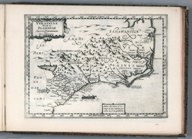
Virginiae Item et Floridae Americae Provinciarum, nova Descriptio.
List No
10534.359
Author
[Mercator, Gerhard, 1512-1594, Hondius, Jodocus, 1563-1612]
Full Title
Virginiae Item et Floridae Americae Provinciarum, nova Descriptio.
List No
10501.508
Author
Cram, George Franklin
Full Title
New Rail Road and County Map of Alabama, Georgia, Sth. Carolina & Northern Florida.
List No
0210.031
Note
Prime meridians Greenwich and Washington.
Full Title
N. & S. Carolina, Georgia & Florida. J.H. Young Sc. (Philadelphia: John Grigg, No. 9 North Fourth Street. 1830)
List No
0315.007
Note
Engraved map. Full hand color. Relief shown pictorially. Prime meridians: Greenwich and Washington.
Author
Mitchell, Samuel Augustus
Full Title
County Map Of Florida. 25. (with) County Map of South Carolina. 26. (with) Inset Map Of Charleston Harbor. 27. Entered ... 1860, by S. Augustus Mitchell, Jr. ... Pennsylvania.
List No
0565.018
Note
States in full color by county.
Author
[Janssonius van Waesberge, Johannes, Mercator, Gerhard, 1512-1594, Cloppenburg, Johannes, 1592-1652]
Full Title
Virginiae item et Floridae Americae Provinciarum, nova descriptio. (to accompany) Atlas sive Cosmographicae Meditationes de Fabrica mundi et fabricati figura. De novo multis in locis emendatus novisque tabulis auctus. Amsterodami, apud Iohannem Ianssonium van Waesberge. Anno, 1673.
List No
11487.177
Note
Copper engraved map of the southeastern part of North America, covers Virginia and Florida. Cover the coast from Chesapeake Bay to St. Augustine. Shows towns, villages, mountains, Indian settlement, and rivers. Relief shown pictorially. Includes notes.
Author
Zatta, Antonio, active 1757-1797
Full Title
Luigiana Inglese, colla Parte Occidentale della Florida, della Giorgia, e Carolina Meridonale. Le Colonie Unite dell' America Settentrle. Fogl. XI. (to accompany) Atlante novissimo ... Tomo IIII. Con privilegio dell Eccelimo Senato. (tomo I-IV).
List No
11598.235
Note
Engraved hand-colored in outline, double-page map. The first edition of Zatta's twelve sheet version of Mitchell's Map of North America, plus three other maps: Il Canada, La Baja D' Hudson, and Le Isole di Terra Nuova e Capo Breton. Zatta's version of Mitchell is not an exact copy: many geographical changes are introduced, and Bermuda is depicted as well as Jamaica, neither of which are shown by Mitchell. Maps showing administrative divisions, settlements, cities, towns, forts, Indian settlements, bridges, canals, mountains and rivers. Relief shown pictorially and by hacures. Includes notations.
Author
Meyer, Joseph, 1796-1856
Full Title
(United States of North America) : Die Staaten von N. & S. Carolina, Georgia & Florida. 1850. Aus der Geograph. Graviranstalt des Bibliograph. Instituts zu Hildburghausen. (in upper margin) Meyer's Zeitung Atlas. No. 76. (to accompany) Neuester Zeitungs-Atlas fur Alte und Neue Erdkunde. Herausgegeben von J. Meyer. (insets) Hafen von St. Augustine. (with) Gold-Region von Nord-Carolina. (with) Newberne. (with) Charleston.
List No
11652.095
Note
Engraved outline hand color map. Shows administrative boundaries, cities and towns. Relief shown by hachures. Prime meridians are Greenwich and Washington.
Author
Seutter, Matthaeus, 1678-1756
Full Title
44. (Coasts of South Carolina, Georgia, Florida. Savannah mills).
List No
12040.109
Note
This map is part of the following map, Plan von Neu Ebenezer. Ruderman: "Important early town plan of New Ebenezer on the Savannah River, accompanied by a large map of the region from Charleston and Augusta, GA in the north to Saint Augustine, Florida, with a smaller inset map of St. Simons River, and Great St. Simon's Island and Jekyl Isle. The map was prepared for Samuel Urlsperger's Ausfürhliche Nachrichten von den saltzburgischen emigranten, published by Matthaeus Seutter, 1747. The map illustrates one of the most interesting early colonies in the southeast. The Salzburgers were a group of Lutherans who were exiled from their homeland in Salzburg, Austria. In 1734, the English Society for Promoting Christian Knowledge sponsored the sea passage of a small group of them to America. Their first settlement, on the Ebenezer River, proved inhospitable, so in 1736 they moved to the banks of the Savannah River, where they founded New Ebenezer. With Savannah, founded only three years earlier, as a model, New Ebenezer was laid out on a grid pattern, punctuated by open squares and became a thriving locale known for its silk trade. It is now an archaeological site listed on the National Register of Historic Places; only the brick Jerusalem Lutheran Church and a few other buildings survive."
Author
Seutter, Matthaeus, 1678-1756
Full Title
44.(Composite of) Plan von Neu Ebenezer (with) (Coasts of South Carolina, Georgia, Florida. Savannah mills.)
List No
12040.121
Note
Composite of Plan von Neu Ebenezer and the adjoining (Coasts of South Carolina, Georgia, Florida. Savannah mills). Ruderman: "Important early town plan of New Ebenezer on the Savannah River, accompanied by a large map of the region from Charleston and Augusta, GA in the north to Saint Augustine, Florida, with a smaller inset map of St. Simons River, and Great St. Simon's Island and Jekyl Isle. The map was prepared for Samuel Urlsperger's Ausfürhliche Nachrichten von den saltzburgischen emigranten, published by Matthaeus Seutter, 1747. The map illustrates one of the most interesting early colonies in the southeast. The Salzburgers were a group of Lutherans who were exiled from their homeland in Salzburg, Austria. In 1734, the English Society for Promoting Christian Knowledge sponsored the sea passage of a small group of them to America. Their first settlement, on the Ebenezer River, proved inhospitable, so in 1736 they moved to the banks of the Savannah River, where they founded New Ebenezer. With Savannah, founded only three years earlier, as a model, New Ebenezer was laid out on a grid pattern, punctuated by open squares and became a thriving locale known for its silk trade. It is now an archaeological site listed on the National Register of Historic Places; only the brick Jerusalem Lutheran Church and a few other buildings survive."
Author
[3, Soviet Union. Glavnoe upravlenie geodezii i kartografii]
Full Title
Юго-Восток США = IUgo-Vostok Ssha. 236-237. Atlas Mira : 1954.
List No
13682.250
Note
Physical map of the Southeast of the United States. Showing state boundaries. Relief shown by shadings and spot heights. Depths shown by gradient tints, isolines and soundings.
Author
Cassini, Gio. Ma. (Giovanni Maria), 1745-approximately 1824
Full Title
(28) Gli Stati Uniti dell'America delineati sulle ultime osservazioni. Quinto foglio che comprende la Georgia, e parte della Carolina con, la Florida. Roma, presso la Calcografia Camerale, 1797.
List No
14000.199
Note
Relief shown pictorially. Includes decorative title cartouche and bar scales. In Volume III.
Author
USSR (Union of Soviet Socialist Republics).
Full Title
203-204. United States of America, South East. The World Atlas.
List No
1603.215
Author
Lloyd, H.H.
Full Title
Atlas of the United States. Florida, Georgia, and South Carolina. (by H.H. Lloyd. Published by Stedman, Brown & Lyon, Baltimore. 1873)
List No
2239.030
Note
Hand col. lithographed map. Counties in full color.
Author
Robert Laurie & James Whittle
Full Title
A new and general map of the southern dominions belonging to the United States of America, viz: North Carolina, South Carolina, and Georgia: with the bordering Indian countries, and the Spanish possessions of Louisiana and Florida. (with) Plan of Charlestown. (with) Plan of St. Augustine. London, Published by Laurie & Whittle, No. 53, Fleet Street, as the act directs 12th May, 1794.
List No
2310.088
Note
Hand colored engraved map with 2 insets. Relief shown pictorially. Shows settlements, roads, Indian tribes, etc.
Author
[Gray, Ormando Willis, Lloyd, H.H., Walling, H. F.]
Full Title
Atlas of the United States. Florida, Georgia, and South Carolina. (Published by Stedman, Brown & Lyon, Cincinnati. 1872. Entered ... 1872, by H.F. Walling, and O.W. Gray, and H.H. Lloyd & Co. ... Washington)
List No
2710.035
Note
Hand col. lithographed map. Counties in full color.
Author
Lange, Henry, 1821-1893.
Full Title
Alabama, Georgia, Sud Carolina und Florida. H. Lange's Atlas v. Nord Amerika Blatt V. Braunschweig: Verlag v. George Westermann. Lith. Anst. von L. Kraatz in Berlin.
List No
2743.005
Note
Engraved map. Borders hand col. Shows roads, railroads, swamps, etc. Relief shown by hachures.
Author
Fullarton, A. & Co.
Full Title
Southern Ports & Harbours in the United States. By J. Bartholomew, F.R.G.S. (with) eight maps. LXa. A. Fullarton & Co. London and Edinburgh.
List No
3007.062
Note
Maps in full color. Eight maps include: (1) Washington. (2) Beaufort Harbour. North Carolina. (3) Charleston Harbour. South Carolina. (4) Mobile Bay. (5) Pensacola Bay. Florida. (6) Key West Island. Florida. (7) Delta of the Mississippi & Environs of New Orleans. (8) Galveston Entrance. Texas.
Author
[Johnston, Alexander Keith, 1804-1871, Rogers, Henry Darwin]
Full Title
States Of South Carolina, Georgia, Alabama, And Florida. By Prof. H.D. Rogers & A. Keith Johnston, F.R.S.E. Entered in Sta. Hall. London ... & according to an act of Congress ... 1857, by H.D. Rogers ... Massachusetts. London, John Murray, Albemarle Street, Edinburgh, W. & A.K. Johnston. Engraved by W. & A.K. Johnston, Edinburgh.
List No
3825.016
Note
States and counties shown in outline printed color. Bahamas shown off the Florida coast.
Author
Cram, George Franklin
Full Title
New Rail Road and County Map of Alabama, Georgia, Sth. Carolina & Northern Florida.
List No
4558.031
Author
Rand McNally and Company
Full Title
Commercial Atlas of America. Rand McNally Auto Trails Map. District No. 21. Florida, Georgia, Alabama, So. Tennessee, So. No. Carolina, Mississippi, So. Carolina, and S.E. Louisiana. Key to trail and highway numbers and markings.
List No
5028.055
Note
Shows roads and distances.
Author
Marbut, Curtis F.
Full Title
Soil Map of the United States by Curtis F. Marbut and Associates in the Soil Survery, U.S. Department of Agriculture, F.J. Marschner, Cartographer and Associate in Compilation. 1931. Soils, Plate 5, Section 9. Lith. A. Hoen & Co., Inc. Atlas of American Agriculture.
List No
5797.105
Note
Includes legend of 12 map sections. Includes soils legend for this section and landscape photographs.
1-22 of 22
|