|
Author
Society for the Diffusion of Useful Knowledge (Great Britain)
Full Title
Geological Map of England and Wales.
List No
10911.012
Author
Society for the Diffusion of Useful Knowledge (Great Britain)
Full Title
The Turkish Empire in Europe and Asia with the Kingdom of Greece.
List No
10911.050
Author
Society for the Diffusion of Useful Knowledge (Great Britain)
Full Title
Arabia with Egypt, Nubia, and Abyssinia.
List No
10911.054
Author
Society for the Diffusion of Useful Knowledge (Great Britain)
Full Title
Persia with Part of the Ottoman Empire.
List No
10911.055
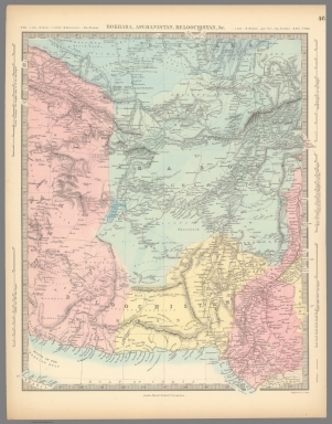
Author
Society for the Diffusion of Useful Knowledge (Great Britain)
Full Title
Bokhara, Afghanistan, Beloochistan, &c.
List No
10911.056
Author
Society for the Diffusion of Useful Knowledge (Great Britain)
Full Title
China, the Interior Chiefly from the Jesuits 1710 to 1718, and the Sea Coast from Modern Authorities.
List No
10911.060
Author
Society for the Diffusion of Useful Knowledge (Great Britain)
Full Title
Empire of Japan, Yedo ... Meaco. (insets) Nagasaki Harbour. Eastern Point of Yeso.
List No
10911.063
Author
Society for the Diffusion of Useful Knowledge (Great Britain)
Full Title
Africa.
List No
10911.064
Author
Society for the Diffusion of Useful Knowledge (Great Britain)
Full Title
The United States of North America.
List No
10911.075
Author
Society for the Diffusion of Useful Knowledge (Great Britain)
Full Title
The Australian Colonies. (insets) The World ... with Distances from Australian Ports. Tasmania.
List No
10911.080
Note
Fold-out map.
Author
Society for the Diffusion of Useful Knowledge (Great Britain)
Full Title
London.
List No
10911.093
Author
[Enthoffer, Joseph, 1818-1901, Bastert, A., Donegan, P. H.]
Full Title
(Title Page to) Map of the City of Washington : Showing the Sub-Divisions, Grades and General Configuration of the Ground in equidistances from 5 to 5 feet altitude. Compiled with the assistance of the City Sur. P.H. Donegan by A. Bastert and J. Enthoffer. Published by A. Petersen and J. Enthoffer of the U.S. Coast Survey 1872 : For sale by Philp & Solomons.
List No
13552.003
Note
Title page and plan of the City of Washington.
Author
[Enthoffer, Joseph, 1818-1901, Bastert, A., Donegan, P. H.]
Full Title
Map of the City of Washington : Showing the Sub-Divisions ... Published by A. Petersen and J. Enthoffer of the U.S. Coast Survey 1872.
List No
13552.004
Note
Cadastral and topographical map of the City of Washington.
Author
[Enthoffer, Joseph, 1818-1901, Bastert, A., Donegan, P. H.]
Full Title
Map of the City of Washington : Showing the Sub-Divisions ... Published by A. Petersen and J. Enthoffer of the U.S. Coast Survey 1872.
List No
13552.005
Note
Cadastral and topographical map of the City of Washington. Showing President's house and National Observatory.
Author
[Enthoffer, Joseph, 1818-1901, Bastert, A., Donegan, P. H.]
Full Title
Map of the City of Washington : Showing the Sub-Divisions ... Published by A. Petersen and J. Enthoffer of the U.S. Coast Survey 1872.
List No
13552.006
Note
Cadastral and topographical map of the City of Washington. Showing Patent Office and city Hall.
Author
[Enthoffer, Joseph, 1818-1901, Bastert, A., Donegan, P. H.]
Full Title
Map of the City of Washington : Showing the Sub-Divisions ... Published by A. Petersen and J. Enthoffer of the U.S. Coast Survey 1872.
List No
13552.007
Note
Cadastral and topographical map of the City of Washington.
Author
[Enthoffer, Joseph, 1818-1901, Bastert, A., Donegan, P. H.]
Full Title
Map of the City of Washington : Showing the Sub-Divisions ... Published by A. Petersen and J. Enthoffer of the U.S. Coast Survey 1872.
List No
13552.008
Note
Cadastral and topographical map of the City of Washington. Showing Agricultural Bureau and Smithsonian Institute.
Author
[Enthoffer, Joseph, 1818-1901, Bastert, A., Donegan, P. H.]
Full Title
Map of the City of Washington : Showing the Sub-Divisions ... Published by A. Petersen and J. Enthoffer of the U.S. Coast Survey 1872.
List No
13552.009
Note
Cadastral and topographical map of the City of Washington. Showing U.S. Capital building.
Author
[Enthoffer, Joseph, 1818-1901, Bastert, A., Donegan, P. H.]
Full Title
Map of the City of Washington : Showing the Sub-Divisions ... Published by A. Petersen and J. Enthoffer of the U.S. Coast Survey 1872.
List No
13552.010
Note
Cadastral and topographical map of the City of Washington. Showing Alms House Cemetery and Congressional Cemetery.
Author
[Enthoffer, Joseph, 1818-1901, Bastert, A., Donegan, P. H.]
Full Title
Map of the City of Washington : Showing the Sub-Divisions ... Published by A. Petersen and J. Enthoffer of the U.S. Coast Survey 1872.
List No
13552.011
Note
Cadastral and topographical map of the City of Washington. Showing U,S, Arsenal.
Author
[Enthoffer, Joseph, 1818-1901, Bastert, A., Donegan, P. H.]
Full Title
Map of the City of Washington : Showing the Sub-Divisions ... Published by A. Petersen and J. Enthoffer of the U.S. Coast Survey 1872.
List No
13552.012
Note
Cadastral and topographical map of the City of Washington. Showing Navy Yard.
Author
Spielmann and Brush
Full Title
Map of property belonging o S. Benson and B. Vredenbergh, Decd. in the Twelfth Ward of the City of New York. Copied in the Registrer's Office, City of New York; Dec. 20nd. 1872. Published by Spielmann & Brush, civil engineers, Hoboken, N.J. 1881. (to accompany) Certified copies of original maps of property in New York City.
List No
13338.012
Note
Hand colored cadastral map. Includes notes and names of adjoining landholders. Oriented with north to the upper left.
Author
Spielmann and Brush
Full Title
3d. Ave. Tract. Published by Spielmann & Brush, civil engineers, Hoboken, N.J. 1881. (to accompany) Certified copies of original maps of property in New York City.
List No
13338.013
Note
Hand colored cadastral map on 2 sheets. Includes notes and names of adjoining landholders. Oriented with north to the upper right.
Author
[Meyer, Herrmann Julius, 1826-1909., Ravenstein, Ludwig]
Full Title
Der Nordliche Sternhimmel. L. Ravenstein dir. Stich. Druck u. Verlag des Bibliographischen Instituts zu Hildburghausen. Stich. v. E. Kuhn u. R. Seidel. (to accompany) Meyer's Hand-Atlas ... 1872.
List No
13324.012
Note
Map of the Northern Starry Sky.
Author
[Meyer, Herrmann Julius, 1826-1909., Ravenstein, Ludwig]
Full Title
Das Sonnensystem. L. Ravenstein Corr. I. Stich. Druck u. Verlag des Bibliographischen Instituts zu Hildburghausen. Stich. v. C. Metzeroth. (to accompany) Meyer's Hand-Atlas ... 1872.
List No
13324.013
Note
Map of the solar system, with orbits of the planets and several comets. Surrounded by various planets, charts, text and tables.
Author
[Meyer, Herrmann Julius, 1826-1909., Ravenstein, Ludwig]
Full Title
Oro- hydrographische karte von Europa. Gaz. v. L. Ravenstein. Stich. Druck u. Verlag des Bibliographischen Instituts zu Hildburghausen. Stich. v. H. Petters. (to accompany) Meyer's Hand-Atlas ... 1872.
List No
13324.017
Note
Color Orohydrographic map of Europe, with inset: Ideales profil sur Erklaurung der Hohenschichten. Map showing rivers, drainage and mountains. Relief shown by gradient tints. Depth shown by isolines. Prime meridian is Ferro and Paris.
Author
Andreas, A. T. (Alfred Theodore), 1839-1900
Full Title
Sectional Map of Illinois ... 1872.
List No
0015.004
Note
Includes population statistics.
Author
Andreas, A. T. (Alfred Theodore), 1839-1900
Full Title
Adams County.
List No
0015.006
Author
Andreas, A. T. (Alfred Theodore), 1839-1900
Full Title
Map of Northeast Township.
List No
0015.085
Author
Andreas, A. T. (Alfred Theodore), 1839-1900
Full Title
Map of Houston Township.
List No
0015.087
Author
Andreas, A. T. (Alfred Theodore), 1839-1900
Full Title
Map of Keene Township.
List No
0015.089
Author
Andreas, A. T. (Alfred Theodore), 1839-1900
Full Title
Map of Lima Township.
List No
0015.091
Author
Andreas, A. T. (Alfred Theodore), 1839-1900
Full Title
Map of Ursa Township. Map of Mendon Township.
List No
0015.092
Author
Andreas, A. T. (Alfred Theodore), 1839-1900
Full Title
Map of Honey Creek Township.
List No
0015.093
Author
Andreas, A. T. (Alfred Theodore), 1839-1900
Full Title
Map of Camp Point Township.
List No
0015.095
Author
Andreas, A. T. (Alfred Theodore), 1839-1900
Full Title
Map of Camp Point, Camp Point Township. (View) Residence of Origen Wallace.
List No
0015.097
Author
Andreas, A. T. (Alfred Theodore), 1839-1900
Full Title
Map of Clayton Township.
List No
0015.099
Author
Andreas, A. T. (Alfred Theodore), 1839-1900
Full Title
Map of Clayton. Map of Loraine. Map of Mendon. Map of New Liberty (Liberty). Map of Marcelline.
List No
0015.101
Author
Andreas, A. T. (Alfred Theodore), 1839-1900
Full Title
Map of Concord Township.
List No
0015.103
Author
Andreas, A. T. (Alfred Theodore), 1839-1900
Full Title
Map of Columbus Township.
List No
0015.105
Author
Andreas, A. T. (Alfred Theodore), 1839-1900
Full Title
Map of Burton. Map of Columbus. Map of Laprairie.
List No
0015.107
Author
Andreas, A. T. (Alfred Theodore), 1839-1900
Full Title
Map of Gilmer Township.
List No
0015.109
Author
Andreas, A. T. (Alfred Theodore), 1839-1900
Full Title
Map of Ellington Township. (inset) Map of Bloomfield.
List No
0015.111
Author
Andreas, A. T. (Alfred Theodore), 1839-1900
Full Title
Map of Quincy.
List No
0015.112
Author
Andreas, A. T. (Alfred Theodore), 1839-1900
Full Title
Quincy Original and Parts of Its Additions.
List No
0015.113
Author
Andreas, A. T. (Alfred Theodore), 1839-1900
Full Title
Map of Melrose Township. Map of Beverly. Map of Kingston.
List No
0015.114
Author
Andreas, A. T. (Alfred Theodore), 1839-1900
Full Title
Map of Burton Township.
List No
0015.115
Author
Andreas, A. T. (Alfred Theodore), 1839-1900
Full Title
(View) Map of Liberty Township.
List No
0015.117
Author
Andreas, A. T. (Alfred Theodore), 1839-1900
Full Title
Map of McKee Township.
List No
0015.119
Author
Andreas, A. T. (Alfred Theodore), 1839-1900
Full Title
Map of Beverly Township.
List No
0015.121
|