|
Author
[Arrowsmith, John, 1790-1873, McLaren, J.]
Full Title
Country South of Adelaide from O’Halloran Hill to Mt. Terrible including district C. and portions of districts B. and D. Surveyed by J. Mc. Laren Esqr. John Arrowsmith 10 Soho Square 1840. London, Published Septr. 1st. 1842, by John Arrowsmith, 10, Soho Square.
List No
14506.086
Note
Map representing the current-day suburbs south of Adelaide, Australia. Shows property boundaries, roads, topography, drainage, and coastlines. Relief shown with hachures. Includes a compass rose with north oriented toward top of sheet, as well as a bar scale given in chains and miles. Hand-colored engraving. The southernmost section of the map appears on a loose sheet inserted here in the volume. All together, map is 69 x 50 cm, on double sheet 67 x 56 cm and loose sheet 23 x 56 cm.
Author
Arrowsmith, John, 1790-1873
Full Title
Map and chart of Norfolk Island from the actual survey, 1840. London. Pubd. 15th June 1842 - by J. Arrowsmith, 10 Soho Square.
List No
14506.089
Note
Map representing Norfolk Island, Australia. Shows political boundaries, cities, roads, topography, drainage, coastlines, islands, and water depths. Relief shown with hachures. Includes informational text, a compass rose with north oriented toward top of sheet, as well as a bar scale given in chains and English miles. With ancillary map: Phillip Island. Hand-colored engraving. Map is 47 x 61 cm, on double sheet 56 x 68 cm.
Author
[Reymann, Daniel Gottfried, Flemming, Carl]
Full Title
5 Putzig
List No
10605.005
Author
[Reymann, Daniel Gottfried, Flemming, Carl]
Full Title
6 Hela
List No
10605.006
Author
[Reymann, Daniel Gottfried, Flemming, Carl]
Full Title
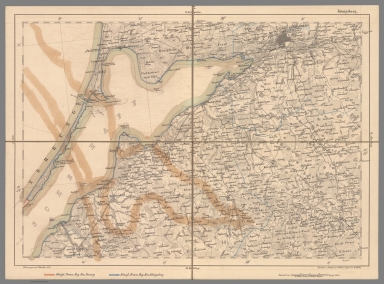
7 Koenigsberg
List No
10605.007
Note
Date estimated.
Author
Tallis, John, 1817-1876
Full Title
No. 1.] King William Street, London Bridge.
List No
14002.007
Note
Engraved map shows profile of buildings on each side of the street, with one side appearing upside-down on the page. Includes an ancillary overview map placing the location of the street within its London neighborhood. With an engraved view featuring: New London Bridge, commenced July 5, 1825, opened August 1, 1832. No. 1 accompanied by a directory (on verso of front cover), as well as four pages of historical and descriptive text, beginning: New London Bridge was commenced in 1825, and completed in 1831, at the expense of the city, and is one of the most noble bridges in the world ... [surrounded by advertisements]. Cover advertises: Any street already published may be had separately, on a sheet of letter paper for correspondence with country friends, for three half-pence each sheet. Bound in pink paper wrappers.
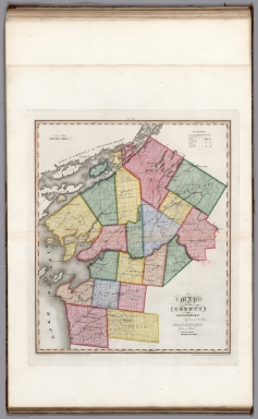
Author
Burr, David H., 1803-1875
Full Title
Map of the State of New-York and the Surrounding Country.
List No
0105.025
Author
Burr, David H., 1803-1875
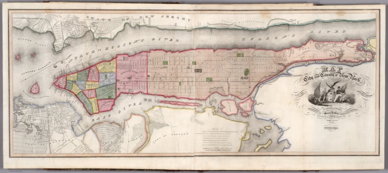
Full Title
Map of the City and County of New York.
List No
0105.026
Note
Foldout. Third edition.
Author
Burr, David H., 1803-1875
Full Title
Map of the Counties of New York, Queens, Kings, and Richmond.
List No
0105.028
Author
Burr, David H., 1803-1875
Full Title
Map of the County of Suffolk (New York).
List No
0105.030
Note
Foldout.
Author
Burr, David H., 1803-1875
Full Title
Map of the County of Westchester. (New York).
List No
0105.032
Author
Burr, David H., 1803-1875
Full Title
Map of the Counties of Dutchess and Putnam (New York).
List No
0105.034
Author
Burr, David H., 1803-1875
Full Title
Map of the Counties of Orange and Rockland (New York).
List No
0105.036
Author
Burr, David H., 1803-1875
Full Title
Map of the County of Ulster (New York).
List No
0105.038
Author
Burr, David H., 1803-1875
Full Title
Map of the County of Sullivan (New York).
List No
0105.040
Author
Burr, David H., 1803-1875
Full Title
Map of the County of Delaware (New York).
List No
0105.042
Author
Burr, David H., 1803-1875
Full Title
Map of the County of Greene (New York).
List No
0105.044
Author
Burr, David H., 1803-1875
Full Title
Map of the County of Columbia (New York).
List No
0105.046
Author
Burr, David H., 1803-1875
Full Title
Map of the County of Rensselaer (New York).
List No
0105.048
Author
Burr, David H., 1803-1875
Full Title
Map of the Counties of Albany and Schenectady (New York). (inset) City of Albany.
List No
0105.050
Author
Burr, David H., 1803-1875
Full Title
Map of the County of Schoharie (New York).
List No
0105.052
Author
Burr, David H., 1803-1875
Full Title
Map of the County of Montgomery and Fulton (New York).
List No
0105.054
Author
Burr, David H., 1803-1875
Full Title
Map of the County of Hamilton (New York).
List No
0105.056
Author
Burr, David H., 1803-1875
Full Title
Map of the County of Saratoga (New York).
List No
0105.058
Author
Burr, David H., 1803-1875
Full Title
Map of the County of Washington (New York).
List No
0105.060
Author
Burr, David H., 1803-1875
Full Title
Map of the County Warren (New York).
List No
0105.062
Author
Burr, David H., 1803-1875
Full Title
Map of the County of Essex (New York).
List No
0105.064
Author
Burr, David H., 1803-1875
Full Title
Map of the County of Clinton (New York).
List No
0105.066
Author
Burr, David H., 1803-1875
Full Title
Map of the County of Franklin (New York).
List No
0105.068
Author
Burr, David H., 1803-1875
Full Title
Map of the County of St. Lawrence (New York).
List No
0105.070
Author
Burr, David H., 1803-1875
Full Title
Map of the County of Jefferson (New York).
List No
0105.072
Author
Burr, David H., 1803-1875
Full Title
Map of the County of Lewis (New York).
List No
0105.074
Author
Burr, David H., 1803-1875
Full Title
Map of the County of Herkimer (New York).
List No
0105.076
Author
Burr, David H., 1803-1875
Full Title
Map of the County of Oneida (New York).
List No
0105.078
Author
Burr, David H., 1803-1875
Full Title
Map of County of Madison (New York).
List No
0105.080
Author
Burr, David H., 1803-1875
Full Title
Map of the County of Oswego (New York).
List No
0105.082
Author
Burr, David H., 1803-1875
Full Title
Map of the County of Otsego (New York).
List No
0105.084
Author
Burr, David H., 1803-1875
Full Title
Map of the County of Chenango (New York).
List No
0105.086
Author
Burr, David H., 1803-1875
Full Title
Map of County of Broome (New York).
List No
0105.088
Author
Burr, David H., 1803-1875
Full Title
Map of the County of Cortland (New York).
List No
0105.090
Author
Burr, David H., 1803-1875
Full Title
Map of the County of Tompkins.
List No
0105.092
Author
Burr, David H., 1803-1875
Full Title
Map of the County of Chemung and Tioga (New York).
List No
0105.094
Author
Burr, David H., 1803-1875
Full Title
Map of the County of Steuben (New York).
List No
0105.096
Author
Burr, David H., 1803-1875
Full Title
Map of the County of Onondaga (New York).
List No
0105.098
Author
Burr, David H., 1803-1875
Full Title
Map of the County of Cayuga (New York).
List No
0105.100
Author
Burr, David H., 1803-1875
Full Title
Map of the County of Seneca (New York).
List No
0105.102
Author
Burr, David H., 1803-1875
Full Title
Map of the Counties of Ontario and Yates (New York).
List No
0105.104
Author
Burr, David H., 1803-1875
Full Title
Map of the County of Wayne (New York).
List No
0105.106
Author
Burr, David H., 1803-1875
Full Title
Map of the County of Livingston (New York).
List No
0105.108
Author
Burr, David H., 1803-1875
Full Title
Map of the County of Monroe (New York).
List No
0105.110
|


![No. 1.] King William Street, London Bridge.](https://media.davidrumsey.com/MediaManager/srvr?mediafile=/Size3/RUMSEY~8~1/179/14002007.jpg)