|
REFINE
Browse All : Atlas Map of North America from 1889
1-9 of 9
Author
Rand McNally and Company
Full Title
Rand, McNally & Co.'s North America.
List No
2094.002
Note
Countries and states tinted in full color. Three scales. Meridians Washington and Greenwich. Relief shown by hachures.
Author
[Ortelius, Abraham, Schoner, Johann]
Full Title
Maris Pacifici, quod vulgo Mar del Zur, cum regionibus circumiancentibus insulisque in eodem passim sparsis, novissima descriptio. From map of North America by Abrahamus Ortelius, 1589. Reduced. America from a globe in Frankfurt, about 1520. Reduced. Julius Bien, Photo-lith. U.S. Geographical Surveys West of the 100th Meridian. (1889)
List No
2220.034
Note
Color Lithograph reproductions of 2 maps on 1 sheet. Relief shown by hachures. As pl. XXXI in list of plates.
Author
Zaltieri, Bolognino
Full Title
North America by Zaltieri 1566. Reduced. Julius Bien, Photo-lith. U.S. Geographical Surveys West of the 100th Meridian. (1889)
List No
2220.035
Note
Color lithograph reproduction. Relief shown pictorially. As pl. XXXII in list of plates.
Author
Briggs, Henry
Full Title
The north part of America ... R. Elstracke sculpsit. North America from Purchas, 1625. Reduced. Julius Bien, Photo-lith. U.S. Geographical Surveys West of the 100th Meridian. (1889)
List No
2220.037
Note
Color lithograph reproduction. From v. 3 of Purchas his pilgrimes, London, 1625. Shows California as an island. As pl. XXXIV in list of plates.
Author
Wit, Frederik de
Full Title
From a map of America by F. De Wit. Folio, Amsterdam, without date, about 1670. Julius Bien, Photo-lith. U.S. Geographical Surveys West of the 100th Meridian. (1889)
List No
2220.038
Note
Color lithograph reproduction. Relief shown pictorially. Shows California as an island. As pl. XXXV in list of plates.
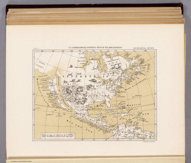
Author
Senex, John
Full Title
From map of North America by John Senex, F.R.S. 1710. Reduced. Julius Bien, Photo-lith. U.S. Geographical Surveys West of the 100th Meridian. (1889)
List No
2220.039
Note
Color lithograph reproduction. Relief shown pictorially. Shows California as an island. As pl. XXXVI in list of plates.
Author
Wells, Edward
Full Title
From map of North America by Edward wells, M.A. 1722. Reduced. Julius Bien, Photo-lith. U.S. Geographical Surveys West of the 100th Meridian. (1889)
List No
2220.040
Note
Color lithograph reproduction. Relief shown pictorially. Shows California as an island. As pl. XXXVII in list of plates.
Author
Jefferys, Thomas
Full Title
From map of North America by Thomas Jefferys. 1782. Reduced. Julius Bien, Photo-lith. U.S. Geographical Surveys West of the 100th Meridian. (1889)
List No
2220.041
Note
Color lithograph reproduction. Relief shown pictorially. As pl. XXXVIII in list of plates.
Author
Cram, George Franklin
Full Title
North America, Engraved Expressly for the Standard World Atlas.
List No
4727.092
Note
Prime meridians Washington D.C. and Greenwich. Relief shown by hachures. With printed color.
1-9 of 9
|