|
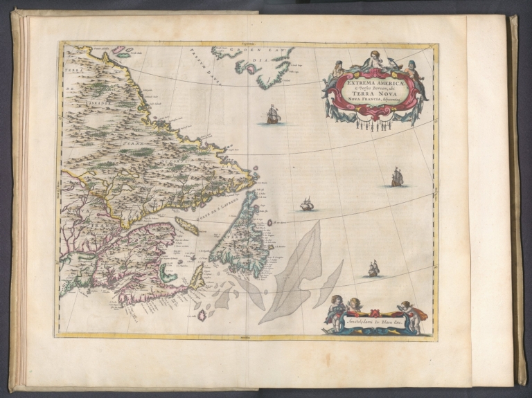
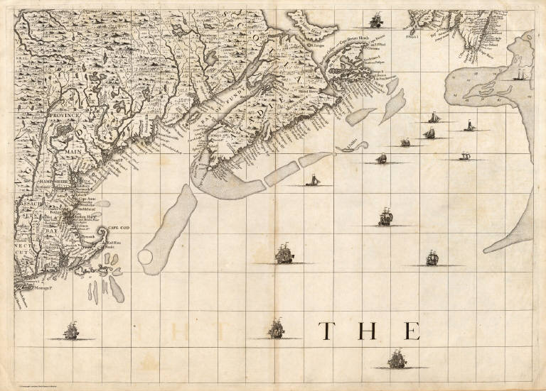
Author
Blaeu, Joan, 1596-1673
Full Title
Extrema Americae Versus Boream
List No
15664.016
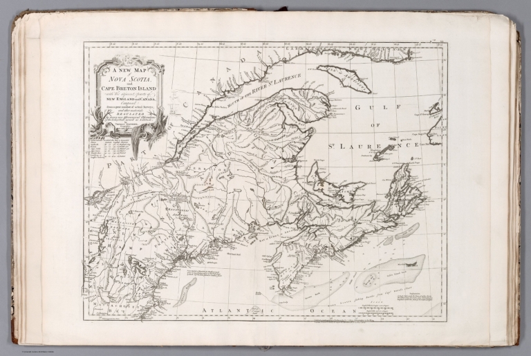
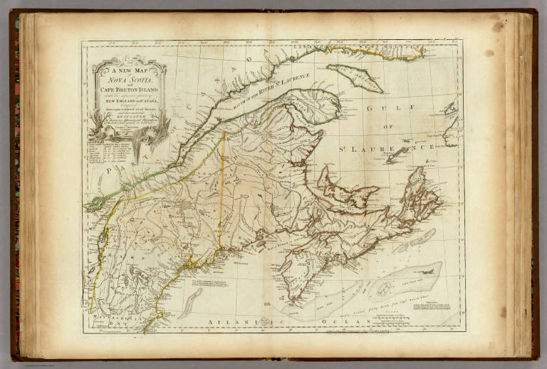
Author
Cook, James, active 1762-1775
Full Title
A new map of Nova Scotia and Cape Breton Island with the adjacent parts of New England and Canada, composed from a great number of actual surveys; and other materials regulated by many new astronomical observations of the longitude as well as latitude; by Thomas Jeffreys, Geographer to the King. London. Published according to Act of Parliament by Thos. Jeffreys, Geographer to the King. London. Printed & sold by R. Sayer and J. Bennett; No. 53, in Fleet Street.
List No
14400.011
Note
Nautical chart of Nova Scotia and Cape Breton Island, circa 1774. Shows cities, fortifications, topography, bodies of water, drainage, bays, ports, anchorage, shoals, rocks and depths, given in fathoms. Relief shown pictorially. Includes rhumb lines, latitudinal and longitudinal lines, as well as two bar scales. Descriptive notes throughout. With table: Observations on which this map is grounded. Decorative cartouche. Black and white copper-engraving. Chart is 47 x 61 cm, on double plate 57 x 76 cm. (Date inferred based upon preceding map.)
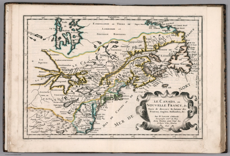
Author
Sanson, Nicolas, 1600-1667
Full Title
Le Canada, ou Nouvelle France &c. : tiree de diverses relations des Francois, Anglois, Hollandois, &c. Par N. Sanson d'Abbeville, Geographe ordre du Roy ... 1657. (to accompany) L'Amerique en plusieurs cartes, & en divers traitte's de geographie et d'histoire ... A Paris chez l'Autheur.
List No
11576.012
Note
Copper engraved double page map of Canada and the Great Lakes. Showing political and administrative boundaries, major cities, towns, villages, rivers, mountains, drainage, etc. Relief shown pictorially.
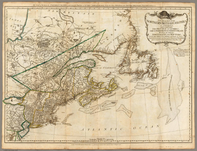
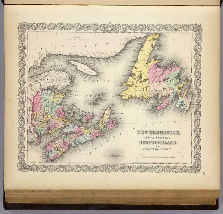
Robert Sayer and John Bennett (Firm) A General Map of the Northern British Co... 1776 0875.003 Related Author
Robert Sayer and John Bennett (Firm)
Full Title
A General Map of the Northern British Colonies in America, which comprehends the Province of Quebec, the Government of Newfoundland, Nova-Scotia, New-England and New-York. from the Maps Published by the Admiralty and Board of Trade, Regulated by the Astronomic and Trigonometric Observations of Major Holland, and Corrected from Governor Pownall's Late Map 1776. London: Printed for Robt. Sayer & Jno. Bennett ... 14th August 1776.
List No
0875.003
Note
In outline color. Above the map reads, "The Seat of War, in the Northern Colonies containing the Province of Quebec, Newfoundland, Nova-Scotia, New-England, New-York, New-Jersey, Pennsylvania, &ca."
Author
Popple, Henry
Full Title
A Map of the British Empire in America with the French and Spanish Settlements adjacent thereto. by Henry Popple. (Sheet 7).
List No
2874.009
Note
Uncolored map covering the area ranging from Massachusetts to the Grand Fishing Bank. Fishing Bank includes soundings.
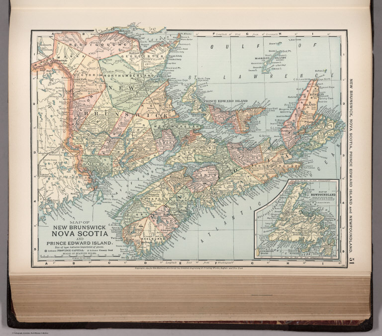
Author
Appleton, D. & Co.
Full Title
Map of New Brunswick, Nova Scotia and Prince Edward Island. Copyright 1891 by Matthews-Northrup Co. ... Buffalo, New York. (with inset) Map of Newfoundland. (to accompany) The Library Atlas Of Modern Geography ... New York, D. Appleton And Company 1892. (on upper margin) New Brunswick, Nova Scotia, Prince Edward Island and Newfoundland 51.
List No
0026.131
Note
Color map. Shows county boundaries and county seat, capital, railways, roads, etc. Note: "Size of type indicates importance of the places". Includes notes. Relief shown by hachures. Prime meridians are Greenwich and Washington.
Author
Arrowsmith, John
Full Title
Lower Canada, New Brunswick, Nova Scotia, Prince Edwards Id., Newfoundland, and a large portion of the United States. By J. Arrowsmith. London, pubd. 15 Feby. 1837 by J. Arrowsmith, 35 Essex Street, Strand.
List No
0036.042
Note
Engraved map. Hand colored boundaries. Relief shown by hachures. Newfoundland shown in inset. Includes New Hampshire, Maine Rhode Island and parts of adjacent states.
Author
Asher & Adams
Full Title
Asher & Adams' Maine and New Brunswick with portions of Quebec & Nova Scotia. Entered according to Act of Congress in the year 1874 by Asher & Adams ... at Washington. (New York, 1874)
List No
0041.004
Note
Hand col. engraved map. Relief shown by hachures and spot heights. Includes inset map. Shows distances along railroads, etc. Prime meridians: Greenwich and Washington.
Bartholomew, John; Black, Adam & Charles Canada, New Brunswick, Nova Scotia, &c.,... 1856 0073.004 Related Author
[Bartholomew, John, Black, Adam & Charles]
Full Title
Canada, New Brunswick, Nova Scotia, &c., East Sheet. Published by A. & C. Black. Edinburgh. Printed in Colours by Schenck & Macfariane. Edinburgh. Drawn & Engraved by J. Bartholomew, Edinburgh.
List No
0073.004
Note
Countries and counties outlined in color. Land tinted. Inset of Newfoundland.
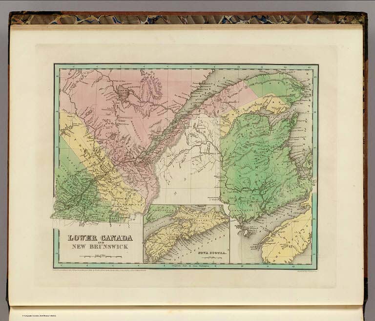
Author
Bradford, Thomas G.
Full Title
Lower Canada and New Brunswick. (inset) Nova Scotia. Entered ... 1838, by T.G. Bradford ... Massachusetts. Engraved by G.W. Boynton.
List No
0089.004
Note
Map in full color.
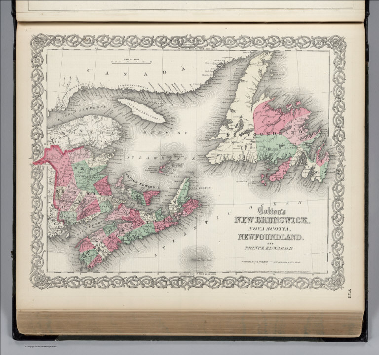
Author
Colton, G.W.
Full Title
New Brunswick, Nova Scotia, Newfoundland, and Prince Edward Id. Published by J.H. Colton & Co. 172 William St. New York. Entered ... 1855 by J.H. Colton ... New York. No. 4.
List No
0149.013
Note
In full color.
Author
Colton, G.W.
Full Title
Colton's New Brunswick, Nova Scotia. Prince Edward Id. & Cape Breton Id. Published By J. H. Colton. No. 172 William St. New York.
List No
0151.020
Note
Prime meridian is Washington D. C.
Author
Colton, G.W.
Full Title
Colton's New Brunswick, Nova Scotia, Newfoundland. And Prince Edward Id. Published By J. H. Colton. No. 172 William St. New York.
List No
0151.021
Note
Prime meridians are Greenwich and Washington D. C.
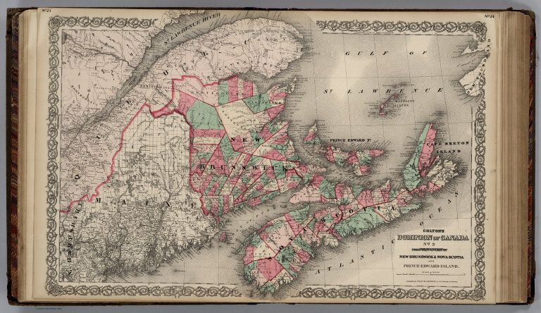
Author
Colton, G.W.
Full Title
Colton's Dominion of Canada, No. 3. The Provinces of New Brunswick & Nova Scotia and Prince Edward Island. Published by G. W & C. B. Colton & Co., No. 172 William St. New York.
List No
0152.020
Note
Prime meridians are Washington D.C. and Greenwich.
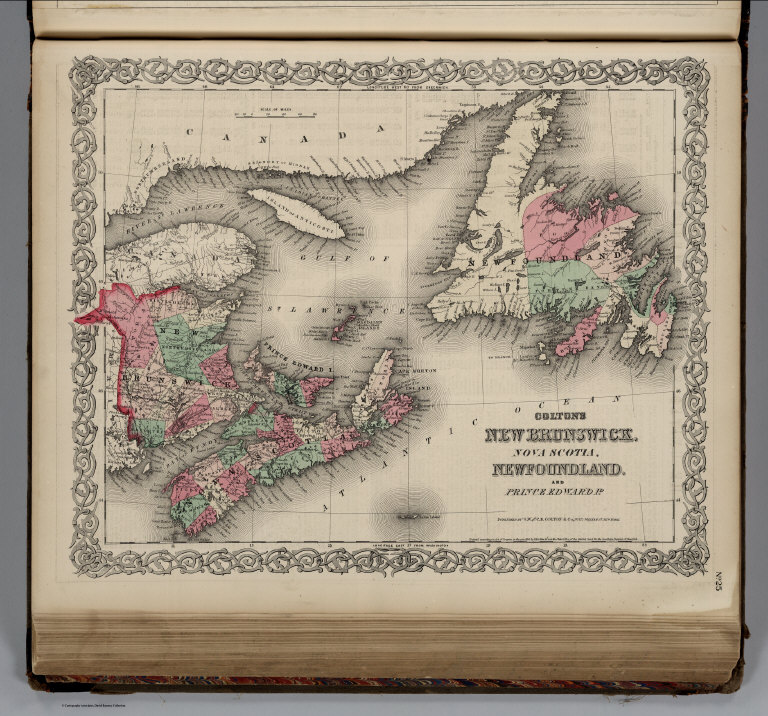
Author
Colton, G.W.
Full Title
Colton's New Brunswick, Nova Scotia, Newfoundland. And Prince Edward Id. Published by G. W & C. B. Colton & Co., No. 172 William St. New York.
List No
0152.021
Note
Prime meridians are Washington D.C. and Greenwich.
Author
Cram, George Franklin
Full Title
Nova Scotia and New Brunswick. (inset) Newfoundland.
List No
0210.020
Note
Prime meridians Greenwich and Washington.
Author
[Bowen, Emanuel, Gibson, John]
Full Title
Nova Scotia. (to accompany) Atlas Minimus or a New Set of Pocket Maps of the Several Empires, Kingdoms and States of the Known World, with Historical Extracts relative to each. Drawn and Engraved by J. Gibson from the Best Authorities, Revis'd, Corrected and Improv'd by Eman: Bowen Geographer to His Majesty.
List No
0300.043
Note
First edition. The "Historical Extracts" are short bits of text printed on the maps giving relevant geographical information. A revised edition was published in London in 1792. In 1759, another edition was published adding separate geographical descriptions and correcting some of the maps (see our copy). The Philadelphia 1798 edition by Mathew Carey incorporates the 1759 edition text word for word (excepting the maps of United States which Carey omits in favor of his pocket atlas of the U.S.). Gibson and Bowen made the four sheet map of North America (Stevens 49), and Gibson made the four sheet map of America (Stevens 3).
Author
[Bowen, Emanuel, Gibson, John]
Full Title
Island Of Cape Breton. (to accompany) Atlas Minimus or a New Set of Pocket Maps of the Several Empires, Kingdoms and States of the Known World, with Historical Extracts relative to each. Drawn and Engraved by J. Gibson from the Best Authorities, Revis'd, Corrected and Improv'd by Eman: Bowen Geographer to His Majesty.
List No
0300.050
Note
First edition. The "Historical Extracts" are short bits of text printed on the maps giving relevant geographical information. A revised edition was published in London in 1792. In 1759, another edition was published adding separate geographical descriptions and correcting some of the maps (see our copy). The Philadelphia 1798 edition by Mathew Carey incorporates the 1759 edition text word for word (excepting the maps of United States which Carey omits in favor of his pocket atlas of the U.S.). Gibson and Bowen made the four sheet map of North America (Stevens 49), and Gibson made the four sheet map of America (Stevens 3).
Author
Gray, O.W.
Full Title
New Brunswick, Nova Scotia, Newfoundland, and Prince Edward Id.
List No
0312.058
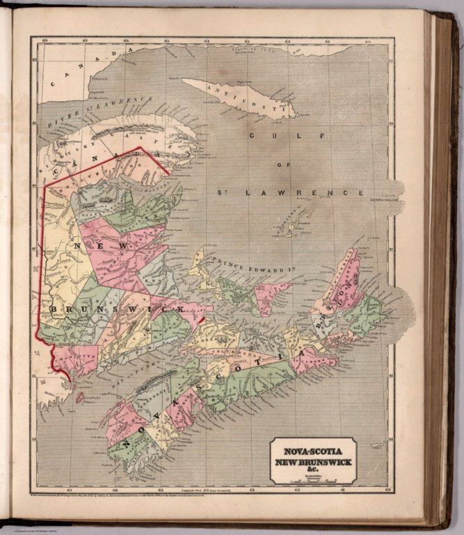
Author
Jefferys, Thomas
Full Title
A New Map of Nova Scotia, and Cape Breton Island with the adjacent parts of New England and Canada, Composed from a great number of actual Surveys; and other materials Regulated by many new Astronomical Observations of the Longitude as well as Latitude; by Thomas Jefferys, Geographer to the King. London. Printed & Sold by R. Sayer & J. Bennett ... 15 June 1775.
List No
0346.016
Note
Chart details "Observations on which this Map is Grounded" with latitude and longitude readings as well as the name of the observer. In outline color.
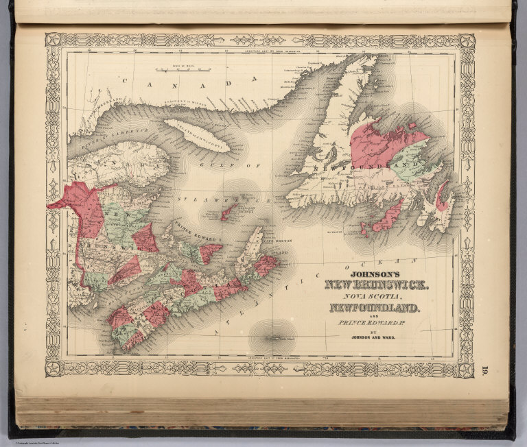
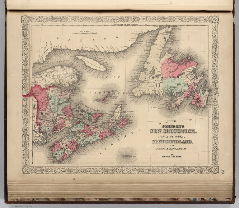
Author
Johnson, A.J.
Full Title
Johnson's New Brunswick, Nova Scotia, Newfoundland. and Prince Edward Id. By Johnson and Ward.
List No
0352.016
Note
Full color by county. Prime meridians are Greenwich and Washington D.C. Relief shown by hachures.
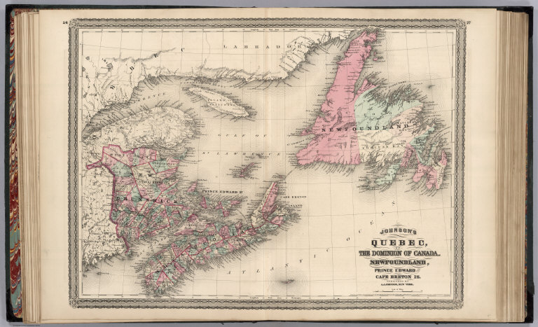
Author
Johnson, A.J.
Full Title
Johnson's Quebec, of the Dominion of Canada. Newfoundland, Prince Edward and Cape Breton Is. Entered ... 1867.
List No
0358.020
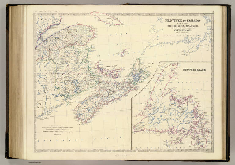
Author
Johnston, Alexander Keith, 1804-1871
Full Title
Province of Canada, eastern sheet, New Brunswick, Nova Scotia, Prince Edward Id., Cape Breton Id. and Newfoundland. By Keith Johnston, F.R.S.E. Engraved & printed by W. & A.K. Johnston, Edinburgh. William Blackwood & Sons, Edinburgh & London, (1861)
List No
0373.048
Note
Engraved map. Boundaries hand col.; hydrography printed in blue. Relief shown by hachures and spot heights. Inset: Newfoundland on same scale. "Keith Johnston's general atlas 43."
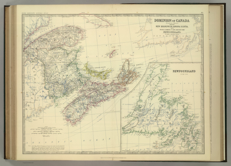
Author
Johnston, Alexander Keith
Full Title
Dominion of Canada (Eastern Sheet) Showing New Brunswick, & Nova Scotia with Prince Edward Id. & Cape Breton Is. and (with) Newfoundland. By Keith Johnston, F.R.S.E. Keith Johnston's General Atlas. Engraved, Printed, and Published by W. & A.K. Johnston, Edinburgh & London.
List No
0377.050
Note
Countries and provinces outlined in color. Relief shown by hachures. Three scales. One inset.
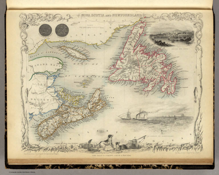
Author
[Martin, R.M., Tallis, J. & F.]
Full Title
Nova Scotia And Newfoundland. The Illustrations by A. Fussell & Engraved by J. Rogers. The Map Drawn & Engraved by J. Rapkin.
List No
0466.070
Note
In outline color with drawings of Halifax, boats in the cod fishing fleet, and Newfoundland dogs. The border incorporates fish on the line and snow covered branches.
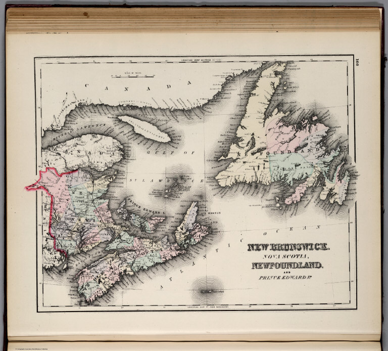
Author
Johnson, A.J.
Full Title
Johnson's New Brunswick, Nova Scotia, Newfoundland. and Prince Edward Id. By Johnson and Ward.
List No
0535.015
Note
In full color by county. Meridians Greenwich and Washington D.C. Relief shown by hachures.
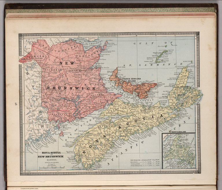
Author
Mitchell, Samuel Augustus
Full Title
County Map Of Nova Scotia New Brunswick Cape Breton Id. And Pr. Edward's Id. 4. (with) inset map City And Harbor Of Halifax. 5. Entered ... 1860, by S. Augustus Mitchell, Jr. ... Pennsylvania.
List No
0565.004
Note
In full printed color by county and region.
Author
Mitchell, Samuel Augustus Jr.
Full Title
County map of Nova Scotia, New Brounswick, Cape Breton Id. and Pr. Edward's Id. Entered ... 1860 by S. Augustus Mitchell, Jr. ... Pennsylvania. (inset map) 5. City and Harbor of Halifax.
List No
0572.009
Note
Hand colored. Prime meridians are Greenwich and Washington, D.C.
Author
Mitchell, Samuel Augustus Jr.
Full Title
County map of Nova Scotia, New Brunswick, Cape Breton Id., and Pr. Edward's Id. (inset map) 6. City and Harbor of Halifax. Entered ... 1867 by S. Augustus Mitchell, Jr. ... Pennsylvania.
List No
0579.009
Note
Color map by county. Relief shown by hachures. Prime meridians are Greenwich and Washington, D.C.
Author
Mitchell, Samuel Augustus
Full Title
County map of Nova Scotia, New Brunswick, Cape Breton Id. and Pr. Edward's Id. (with) City and harbor of Halifax. Entered ... 1879 by S. Augustus Mitchell ... Washington. (1880)
List No
0586.006
Note
Hand colored map with inset. Relief shown by hachures. Shows counties, settlements, rivers, etc. Prime meridians: Greenwich and Washington.
Author
Mitchell, Samuel Augustus Jr.
Full Title
County Map of Nova Scotia, New Brunswick, Cape Breton Id. and Pr. Edward's Id. (with) City and harbor of Halifax. Copyright by S. Augustus Mitchell 1884.
List No
0592.006
Note
Hand colored map with inset of City and Harbor of Halifax. Relief shown by hachures. Shows counties, settlements, rivers, etc. Prime meridians: Greenwich and Washington.
Full Title
County map of Nova Scotia, New Brunswick, Cape Breton Id. and Pr. Edward's Id. (with) City and harbor of Halifax. Copyright 1887 by Wm. M. Bradley & Bro. (1890)
List No
0594.006
Note
Hand colored map with inset. Relief shown by hachures. Shows counties, settlements, rivers, etc. Prime meridians: Greenwich and Washington.
Author
[Morse, Charles W., Colby, Charles A.]
Full Title
Nova-Scotia, New Brunswick &c.
List No
0623.010
Author
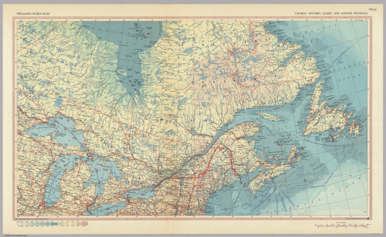
Polish Army Topography Service
Full Title
Canada - Ontario, Quebec, and Maritime Provinces. Pergamon World Atlas. Pergamon Press, Ltd. & P.W.N. Poland 1967. Sluzba Topograficzna W.P.
List No
0737.193
Note
Detailed political and physical map.
Author
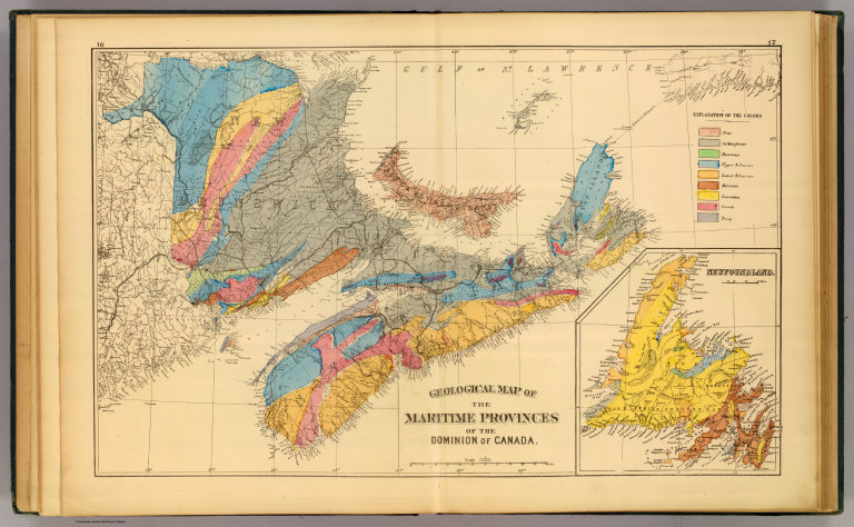
Roe Brothers (Firm)
Full Title
Geological map of the Maritime Provinces of the Dominion of Canada. (with) Newfoundland. (Drawn on the Rectangular polyconic projection. Drawn and published by Roe Brothers, (A.D. & W.B. Roe). Eng. by Worley & Bracher, Philada. Printed by F. Bourquin, Philada. 1878)
List No
0859.001
Note
Hand colored map. Shows 9 geologic units, settlements, railroads, etc.
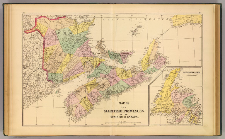
Author
Roe Brothers (Firm)
Full Title
Map of the Maritime Provinces of the Dominion of Canada. (with) Newfoundland. (Drawn on the Rectangular polyconic projection. Drawn and published by Roe Brothers, (A.D. & W.B. Roe). Eng. by Worley & Bracher, Philada. Printed by F. Bourquin, Philada. 1878)
List No
0859.002
Note
Hand colored map. Shows settlements, counties, railroads, etc.
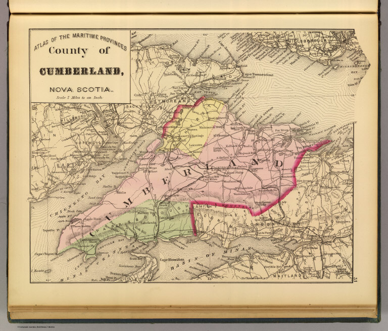
Author
Roe Brothers (Firm)
Full Title
County of Cumberland, Nova Scotia. (Drawn on the Rectangular polyconic projection. Drawn and published by Roe Brothers, (A.D. & W.B. Roe). Eng. by Worley & Bracher, Philada. Printed by F. Bourquin, Philada. 1878)
List No
0859.015
Note
Hand colored map. Relief shown by hachures. Shows administrative subdivisions, settlements, railroads, etc. At head of title: Atlas of the Maritime Provinces.
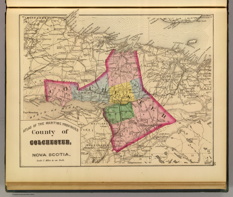
Author
Roe Brothers (Firm)
Full Title
County of Colchester, Nova Scotia. (Drawn on the Rectangular polyconic projection. Drawn and published by Roe Brothers, (A.D. & W.B. Roe). Eng. by Worley & Bracher, Philada. Printed by F. Bourquin, Philada. 1878)
List No
0859.016
Note
Hand colored map. Relief shown by hachures. Shows administrative subdivisions, settlements, railroads, etc. At head of title: Atlas of the Maritime Provinces.
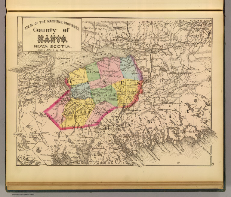
Author
Roe Brothers (Firm)
Full Title
County of Hants, Nova Scotia. (Drawn on the Rectangular polyconic projection. Drawn and published by Roe Brothers, (A.D. & W.B. Roe). Eng. by Worley & Bracher, Philada. Printed by F. Bourquin, Philada. 1878)
List No
0859.017
Note
Hand colored map. Relief shown by hachures. Shows administrative subdivisions, settlements, railroads, etc. At head of title: Atlas of the Maritime Provinces.
Author
Roe Brothers (Firm)
Full Title
County of Kings, Nova Scotia. (Drawn on the Rectangular polyconic projection. Drawn and published by Roe Brothers, (A.D. & W.B. Roe). Eng. by Worley & Bracher, Philada. Printed by F. Bourquin, Philada. 1878)
List No
0859.018
Note
Hand colored map. Relief shown by hachures. Shows administrative subdivisions, settlements, railroads, etc. At head of title: Atlas of the Maritime Provinces.
Author
Roe Brothers (Firm)
Full Title
County of Lunenburg, Nova Scotia. (Drawn on the Rectangular polyconic projection. Drawn and published by Roe Brothers, (A.D. & W.B. Roe). Eng. by Worley & Bracher, Philada. Printed by F. Bourquin, Philada. 1878)
List No
0859.019
Note
Hand colored map. Relief shown by hachures. Shows administrative subdivisions, settlements, railroads, etc. At head of title: Atlas of the Maritime Provinces.
Author
Roe Brothers (Firm)
Full Title
Counties of Annapolis and Queens, Nova Scotia. (Drawn on the Rectangular polyconic projection. Drawn and published by Roe Brothers, (A.D. & W.B. Roe). Eng. by Worley & Bracher, Philada. Printed by F. Bourquin, Philada. 1878)
List No
0859.020
Note
Hand colored map. Relief shown by hachures. Shows administrative subdivisions, settlements, railroad, etc. At head of title: Atlas of the Maritime Provinces. The name "Nova Scotia" in title is on label pasted on.
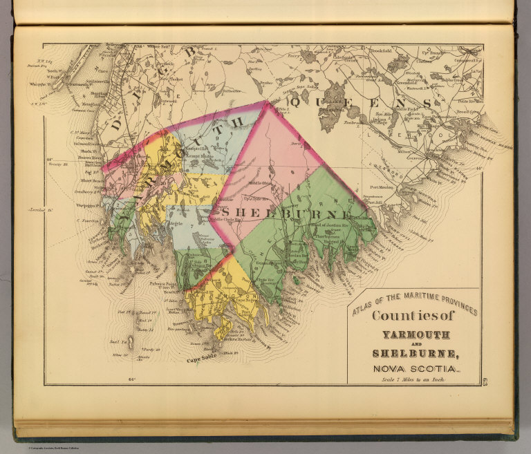
Author
Roe Brothers (Firm)
Full Title
Counties of Yarmouth and Shelburne, Nova Scotia. (Drawn on the Rectangular polyconic projection. Drawn and published by Roe Brothers, (A.D. & W.B. Roe). Eng. by Worley & Bracher, Philada. Printed by F. Bourquin, Philada. 1878)
List No
0859.021
Note
Hand colored map. Relief shown by hachures. Shows administrative subdivisions, settlements, railroad, etc. At head of title: Atlas of the Maritime Provinces.
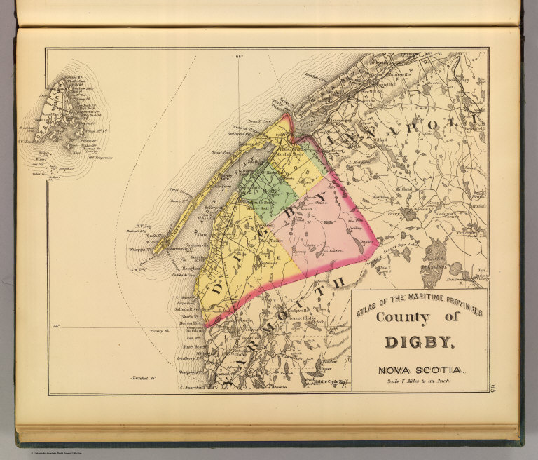
Author
Roe Brothers (Firm)
Full Title
County of Digby, Nova Scotia. (Drawn on the Rectangular polyconic projection. Drawn and published by Roe Brothers, (A.D. & W.B. Roe). Eng. by Worley & Bracher, Philada. Printed by F. Bourquin, Philada. 1878)
List No
0859.022
Note
Hand colored map. Relief shown by hachures. Shows administrative subdivisions, settlements, railroad, etc. At head of title: Atlas of the Maritime Provinces.
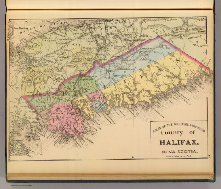
Author
Roe Brothers (Firm)
Full Title
County of Halifax, Nova Scotia. (Drawn on the Rectangular polyconic projection. Drawn and published by Roe Brothers, (A.D. & W.B. Roe). Eng. by Worley & Bracher, Philada. Printed by F. Bourquin, Philada. 1878)
List No
0859.023
Note
Hand colored map. Relief shown by hachures. Shows administrative subdivisions, settlements, railroad, etc. At head of title: Atlas of the Maritime Provinces.
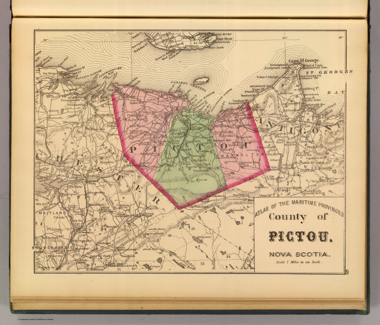
Author
Roe Brothers (Firm)
Full Title
County of Pictou, Nova Scotia. (Drawn on the Rectangular polyconic projection. Drawn and published by Roe Brothers, (A.D. & W.B. Roe). Eng. by Worley & Bracher, Philada. Printed by F. Bourquin, Philada. 1878)
List No
0859.024
Note
Hand colored map. Relief shown by hachures. Shows administrative subdivisions, settlements, railroads, etc. At head of title: Atlas of the Maritime Provinces.
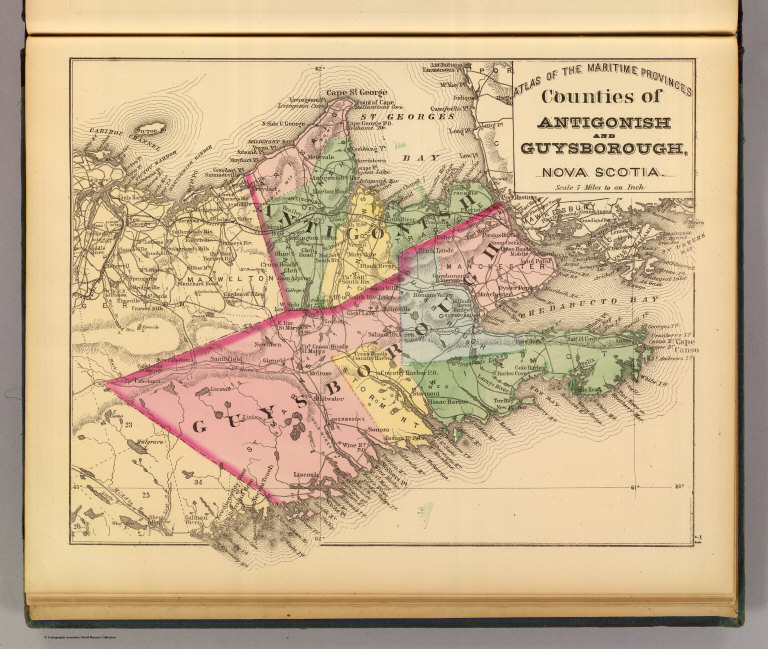
Author
Roe Brothers (Firm)
Full Title
Counties of Antigonish and Guysborough, Nova Scotia. (Drawn on the Rectangular polyconic projection. Drawn and published by Roe Brothers, (A.D. & W.B. Roe). Eng. by Worley & Bracher, Philada. Printed by F. Bourquin, Philada. 1878)
List No
0859.025
Note
Hand colored map. Relief shown by hachures. Shows administrative subdivisions, settlements, railroads, etc. At head of title: Atlas of the Maritime Provinces.
Author
Roe Brothers (Firm)
Full Title
Counties of Inverness and Victoria, Nova Scotia. (with) Magdalin (i.e. Magdalen) Islands. (Drawn on the Rectangular polyconic projection. Drawn and published by Roe Brothers, (A.D. & W.B. Roe). Eng. by Worley & Bracher, Philada. Printed by F. Bourquin, Philada. 1878)
List No
0859.026
Note
Hand colored map. Relief shown by hachures. Shows administrative subdivisions, settlements, railroad, etc. At head of title: Atlas of the Maritime Provinces.
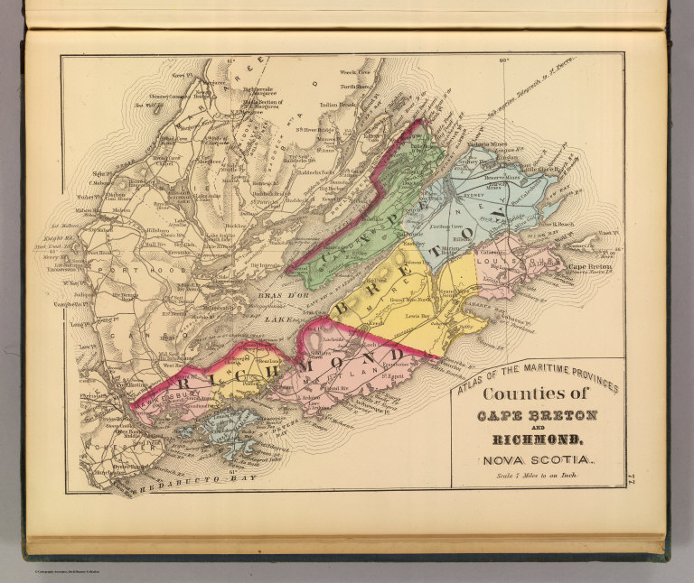
Author
Roe Brothers (Firm)
Full Title
Counties of Cape Breton and Richmond, Nova Scotia. (Drawn on the Rectangular polyconic projection. Drawn and published by Roe Brothers, (A.D. & W.B. Roe). Eng. by Worley & Bracher, Philada. Printed by F. Bourquin, Philada. 1878)
List No
0859.027
Note
Hand colored map. Relief shown by hachures. Shows administrative subdivisions, settlements, railroad, etc. At head of title: Atlas of the Maritime Provinces.
Author
Roe Brothers (Firm)
Full Title
Map of the city of Halifax, Halifax Co., N.S. (Drawn on the Rectangular polyconic projection. Drawn and published by Roe Brothers, (A.D. & W.B. Roe). Eng. by Worley & Bracher, Philada. Printed by F. Bourquin, Philada. 1878)
List No
0859.031
Note
Hand colored map. Relief shown by hachures; soundings in fathoms. Shows administrative subdivisions, major buildings, wharves, radial distances from city center, etc.
|