|
Author
[Humboldt, Alexander von, 1769-1859, Bonpland, Aime]
Full Title
I. Limite inferieure des neiges perpetuelles a differentes latitudes.
List No
12125.023
Note
Shows four peaks from around the world and the elevations of perpetual snow: Chimborazo; Popocatetl; Mont Blanc; Swedish mountains.
Author
[Humboldt, Alexander von, 1769-1859, Bonpland, Aime]
Full Title
III. Profil de la Peninsule Espagnole, pour servie de comparaison aux cartes hypsometriques du Nouvelles-Continent.
List No
12125.025
Author
[Humboldt, Alexander von, 1769-1859, Bonpland, Aime]
Full Title
IV. Chemin de la Guayra a Caracus par la Cumbre.
List No
12125.026
Author
[Humboldt, Alexander von, 1769-1859, Bonpland, Aime]
Full Title
V. Esquisse hypsometrique des noeuds de montagnes et des ramifications de la Cordillere des Andes depuis le cap de Horn jusqu'a l'Isthme de Panama.
List No
12125.027
Author
[Humboldt, Alexander von, 1769-1859, Bonpland, Aime]
Full Title
VI. Profil du chemin de Carthagene des Indes au plateau de Santa-Fe de Bogota.
List No
12125.028
Author
[Humboldt, Alexander von, 1769-1859, Bonpland, Aime]
Full Title
VII. Tableau geognostique des formations de roches entre la villee de Mexico, Moran et Totonilco.
List No
12125.029
Author
[Humboldt, Alexander von, 1769-1859, Bonpland, Aime, Guzman, S.]
Full Title
VIII. Carte itineraire de la route de Zacatecas a Bolanos.
List No
12125.030
Author
[Humboldt, Alexander von, 1769-1859, Bonpland, Aime]
Full Title
X. Carte de la province de Quixos entre le Rio Napo et le dome trachytique d'Antisana.
List No
12125.032
Author
[Humboldt, Alexander von, 1769-1859, Bonpland, Aime, Berghaus, Henri]
Full Title
XI. Carte de la province d'Avila.
List No
12125.033
Author
[Humboldt, Alexander von, 1769-1859, Bonpland, Aime]
Full Title
XII. Plan du port et des environs de Tampico.
List No
12125.034
Author
[Humboldt, Alexander von, 1769-1859, Bonpland, Aime]
Full Title
XIII. Bifurcations et Deltas d'affluens pour servir d'eclaircissement a l'Hydrographie de l'Orenoque.
List No
12125.035
Note
Seven small maps.
Author
[Humboldt, Alexander von, 1769-1859, Bonpland, Aime]
Full Title
XIV. Histoire de la Geographie de l'Orenoque et du Dorado.
List No
12125.036
Note
Eleven small maps with dates ranging from 1599-1778.
Author
[Humboldt, Alexander von, 1769-1859, Bonpland, Aime, Poirson, J.B.]
Full Title
XV. Cours de l'Orenoque depuis l'embouchure du Rio Sinaruco jusqu'a l'Angostura.
List No
12125.037
Author
[Humboldt, Alexander von, 1769-1859, Bonpland, Aime, Poirson, J.B.]
Full Title
XVI. Carte itineraire du cours de l'Orenoque, de l'Atabapo, de Casiquiare et du Rio Negro, offrant la bifurcation de l'Orenoque et sa communication avec la riviere de l'Amazone.
List No
12125.038
Author
[Humboldt, Alexander von, 1769-1859, Bonpland, Aime, Poirson, J.B.]
Full Title
XVII. Cours du Rio Apure et d'une partie ds la chaine de montagnes de la Nouvelle-Grenade.
List No
12125.039
Author
[Humboldt, Alexander von, 1769-1859, Bonpland, Aime, Poirson, J.B.]
Full Title
XVIII. Carte de la partie orientale de la province de Varinas comprise entre l'Orenoque, l'Apure et la Meta.
List No
12125.040
Author
[Humboldt, Alexander von, 1769-1859, Bonpland, Aime, Poirson, J.B.]
Full Title
XIX. Cours du Rio Meta et d'une partie de la chaine de montagnes de la Nouvelle-Granade.
List No
12125.041
Author
[Humboldt, Alexander von, 1769-1859, Bonpland, Aime, Poirson, J.B.]
Full Title
XX. Cours de Rio Caura.
List No
12125.042
Author
[Humboldt, Alexander von, 1769-1859, Bonpland, Aime, Poirson, J.B.]
Full Title
XXI. Cours du Rio Guaviare et de la partie de l'Apure comprise entre la ville de San-Fernando et le confluent de l'Apure avec l'Orenoque.
List No
12125.043
Note
Guaviare River is a tributary to the Orinoco River.
Author
[Humboldt, Alexander von, 1769-1859, Bonpland, Aime, Brue, A.H.]
Full Title
XXII. Carte generale de Colombia.
List No
12125.044
Author
[Humboldt, Alexander von, 1769-1859, Bonpland, Aime, Lapie, P.]
Full Title
XXIII. Carte de l'ile de Cuba, tirage de 1826. (inset) Havane.
List No
12125.045
Author
[Humboldt, Alexander von, 1769-1859, Bonpland, Aime, Michaelis, E.H.]
Full Title
XXIV. Carte du Rio Grande de la Magdalena, depuis ses sources jusqu'a son embouchure.
List No
12125.046
Author
[Humboldt, Alexander von, 1769-1859, Bonpland, Aime, Brue]
Full Title
XXV. Carte hydrographique de la province du Choco. Communication entre l'Ocean Atlantique et la Mer du Sud tentee dans l'isthme de la Raspadura.
List No
12125.047
Author
[Humboldt, Alexander von, 1769-1859, Bonpland, Aime, Michaelis, E.H.]
Full Title
XXVI. Carte geologique de Nevado de Antisana.
List No
12125.048
Author
[Humboldt, Alexander von, 1769-1859, Bonpland, Aime, Michaelis, F.H.]
Full Title
XXVII. Plan hypsometrique du volcan de Pichincha.
List No
12125.049
Author
[Humboldt, Alexander von, 1769-1859, Bonpland, Aime, Rodriquez, Don Juan Jose]
Full Title
XXVIII. Coupe du volcan de Jorullo.
List No
12125.050
Author
[Humboldt, Alexander von, 1769-1859, Bonpland, Aime, Davalos, A., Michaelis, H.]
Full Title
XXX. Esquisse geodesique des environs de Guanaxuato.
List No
12125.052
Author
[Humboldt, Alexander von, 1769-1859, Bonpland, Aime, Roulin, F., Michaelis, H.]
Full Title
XXXI. Carte des Environs de Honda, de Mariquita et des Mines de Santana.
List No
12125.053
Author
[Humboldt, Alexander von, 1769-1859, Bonpland, Aime, Michaelis, H.]
Full Title
XXXII. Carte de l'Isthme de Tehuantepec.
List No
12125.054
Author
[Humboldt, Alexander von, 1769-1859, Bonpland, Aime, de la Cosa, Juan, Michaelis, H.]
Full Title
XXXIV. Fragment de la Mappemonde dessinee au Port de Santa Maria l'An 1500 par Juan de la Cosa.
List No
12125.056
Author
[Humboldt, Alexander von, 1769-1859, Bonpland, Aime, de la Cosa, Juan, Michaelis, H.]
Full Title
XXXV. Fragment de la Mappemonde de Juan de la Cosa tracee in 1500.
List No
12125.057
Author
[Humboldt, Alexander von, 1769-1859, Bonpland, Aime, de la Cosa, Juan, Michaelis, H.]
Full Title
XXXVI. Trois Fragmens de la Mappemonde de Juan de la Cosa tracee in 1500.
List No
12125.058
Author
[Humboldt, Alexander von, 1769-1859, Bonpland, Aime, de la Cosa, Juan, Michaelis, H.]
Full Title
XXXVII. Tabula Terre Nove. Depromta eae ed. Geographiae Ptolemaei Argentor. 1513, in folio.
List No
12125.059
Author
[Humboldt, Alexander von, 1769-1859, Bonpland, Aime, de la Cosa, Juan, Michaelis, H.]
Full Title
XXXVIII. Tabula Moderna Norbegie et Gottie (ex. ed. Geographiae Ptolemaei, Rom. 1508 et Argentor. 1513. in sol). Fragmentum Tabule eui titulus: Orbis Typus Universalis juxta Hydrographorum traditionem ... 1513 ...).
List No
12125.060
Author
[Humboldt, Alexander von, 1769-1859, Bonpland, Aime, Michaelis, H.]
Full Title
XXXIX. Universalior Cogniti Orbis Tabula ... ex. ed. Geographiae Ptolemaei, Romae 1508.
List No
12125.061
Author
Azara, Felix de
Full Title
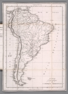
Carte geographique de L'Amerique Meridionale. (to accompany) Voyages dans l'Amerique meridonale, par Don Felix de Azara.1809.
List No
13381.006
Note
Engrave folded map. Shows countries and major cities. Relief shown pictorially. Prime meridians: Paris and Cadiz.
Author
Azara, Felix de
Full Title
Province des Chiquitos. (to accompany) Voyages dans l'Amerique meridonale, par Don Felix de Azara.1809.
List No
13381.010
Note
Engrave folded map of the province of Chiquitos, Bolivia and of part of Brazil. Title from table of contents. Shows major rivers, cities and towns. Relief shown pictorially.
Author
Azara, Felix de
Full Title
Plan de la Peuplade d'Atira. (to accompany) Voyages dans l'Amerique meridonale, par Don Felix de Azara. 1809.
List No
13381.019
Note
Engraved plan. Includes key to the various place on map. Oriented with north to the upper left.
Author
Azara, Felix de
Full Title
Plan de la Peuplade de Candelaria. (to accompany) Voyages dans l'Amerique meridonale, par Don Felix de Azara. 1809.
List No
13381.020
Note
Engraved plan. Includes key to the various place on map. Oriented with north to the upper right.
Author
Azara, Felix de
Full Title
Plan du Port Montevideo sur la Cote septentrionale et a l'Embouchure de la riviere de la Plata. Leve en 1789. (to accompany) Voyages dans l'Amerique meridonale, par Don Felix de Azara. 1809.
List No
13381.024
Note
Engraved map of Port Montevideo on the northern coast and at the mouth of the Plata river. Relief shown by hachures. Scale 2 1/3 inches to a sea mile. Oriented with north to the upper margin.
Author
[Ulloa, Antonio de, 1716-1795, Juan, Jorge, 1713-1773]
Full Title
El Puerto de el Callao, en el Mar Pacyfyco, o de el Sur : Con las Costas immediatas à el de Barlovento, y Sotavento Islas Yarrecifes que se comprehenden, y la Sonda numerada en Brazas.
List No
14378.058
Note
Map featuring Callao, Peru. Shows ports, topography, vegetation, drainage, coastline, islands and depths. Relief shown pictorially. Includes explanatory notes, two bar scales, as well as a compass rose with north oriented toward left side of sheet. Indexed to indicate place names, with key at lower left. With decorative cartouches. Black and white engraving. Map is 25 x 37 cm, on fold-out sheet 27 x 50 cm. Appears in the third volume of Relacion historica del viage hecho de orden de S. Mag. a la America Meridional.
Author
[Ulloa, Antonio de, 1716-1795, Juan, Jorge, 1713-1773]
Full Title
Plano de la Isla Tra. de Juan Fernandez en el Mar del Sur y en la Latitud Austral ... año de 1744.
List No
14378.060
Note
Map featuring the Juan Fernández Islands, off the coast of Chile. Shows topography, vegetation, drainage, coastline, islands, depths and anchorage. Relief shown pictorially. Includes explanatory notes, as well as a bar scale and compass rose with north oriented toward top of sheet. With decorative cartouche. Black and white engraving. Map is 23 x 31 cm, on fold-out sheet 27 x 40 cm. Appears in the third volume of Relacion historica del viage hecho de orden de S. Mag. a la America Meridional.
Author
[Ulloa, Antonio de, 1716-1795, Juan, Jorge, 1713-1773]
Full Title
Plano de la Bahia de la Concepcion en las Costas del Mar del Sur ... año de 1744. Pautus Minguet sculp.
List No
14378.063
Note
Map featuring Concepción Bay, Chile. Shows settlements, topography, vegetation, drainage, coastline, islands, depths and anchorage. Relief shown pictorially. Includes explanatory notes, as well as a bar scale and compass rose with north oriented toward left side of sheet. With decorative cartouche. Black and white engraving. Map is 24 x 39 cm, on fold-out sheet 33 x 51 cm. Appears in the third volume of Relacion historica del viage hecho de orden de S. Mag. a la America Meridional.
Author
[Ulloa, Antonio de, 1716-1795, Juan, Jorge, 1713-1773]
Full Title
Plano de la entrada en el Golfo de Chiloè, y Puerto de Chacao, en las Costas del Mar del Sur ... año de 1744. Pautus Minguet sculp.
List No
14378.065
Note
Map featuring the Gulf of Chiloé, Chile. Shows settlements, topography, vegetation, drainage, coastline, islands, depths and anchorage. Relief shown pictorially. Includes explanatory notes, as well as a bar scale and compass rose with north oriented toward top of sheet. With decorative cartouche. Black and white engraving. Map is 28 x 38 cm, on fold-out sheet 38 x 46 cm. Appears in the third volume of Relacion historica del viage hecho de orden de S. Mag. a la America Meridional.
Author
[Ulloa, Antonio de, 1716-1795, Juan, Jorge, 1713-1773]
Full Title
Plano de la Ensenada y Puerto de Valparaiso, en las Costas del Mar del Sur ... año de 1744. Fuente F. M.
List No
14378.066
Note
Map featuring Valparaíso Bay, Chile. Shows settlements, topography, vegetation, drainage, coastline, islands, depths and anchorage. Relief shown pictorially. Includes explanatory notes, as well as a bar scale and compass rose with north oriented toward bottom left of sheet. Indexed to indicate place names, with key at bottom. With decorative cartouche. Black and white engraving. Map is 26 x 39 cm, on fold-out sheet 32 x 51 cm. Appears in the third volume of Relacion historica del viage hecho de orden de S. Mag. a la America Meridional.
Author
[Geographical and Geological Survey of the Rocky Mountain Region (U.S.), Graves, W. H., Renshawe, J. H. (John Henry), 1852-, Thompson, A. H. (Almon Harris), 1839-1906]
Full Title
Map of the district of the High Plateaus of Utah. Triangulation by A.H. Thompson, topographers J.H. Renshawe, W.H. Graves. Dept. of the Interior, U.S. G. and G. Survey, J.W. Powell in charge. Atlas sheet no. 1, Geology of the high plateaus of Utah by Capt. C.E. Dutton, U.S.A. (Julius Bien, Lith., New York, 1879)
List No
2080.001
Note
Lithographed map. Contour interval 250 ft.
Author
[Dutton, Clarence E. (Clarence Edward), 1841-1912, Geographical and Geological Survey of the Rocky Mountain Region (U.S.), Graves, W. H., Renshawe, J. H. (John Henry), 1852-, Thompson, A. H. (Almon Harris), 1839-1906]
Full Title
Geological map of the district of the high plateaus of Utah. Triangulation by A.H. Thompson, topographers J.H. Renshawe, W.H. Graves. Geology by Capt. C.E. Dutton, U.S.A. Dept. of the Interior, U.S. G. and G. Survey, J.W. Powell in charge. Atlas sheet no. 2, Geology of the high plateaus of Utah by Capt. C.E. Dutton, U.S.A. (Julius Bien, Lith., New York, 1879)
List No
2080.002
Note
Color lithographed map. Contour interval 250 ft.
Author
[Dutton, Clarence E. (Clarence Edward), 1841-1912, Geographical and Geological Survey of the Rocky Mountain Region (U.S.)]
Full Title
Relief map of the district of the high plateaus of Utah. Dept. of the Interior, U.S. G. and G. Survey, J.W. Powell in charge. Atlas sheet no. 3, Geology of the high plateaus of Utah by Capt. C.E. Dutton, U.S.A. (Julius Bien, Lith., New York, 1879)
List No
2080.003
Note
Lithographed map. Printed in sepia color. Relief shown by shading.
Author
[Dutton, Clarence E. (Clarence Edward), 1841-1912, Geographical and Geological Survey of the Rocky Mountain Region (U.S.)]
Full Title
Map of portions of Utah and Arizona showing the arrangement of faults and flexures in the Kaibabs and high plateaus. Dept. of the Interior, U.S. G. and G. Survey, J.W. Powell in charge. Atlas sheet no. 4, Geology of the high plateaus of Utah by Capt. C.E. Dutton, U.S.A. (Julius Bien, Lith., New York, 1879)
List No
2080.004
Note
Lithographed map. Relief shown by hachures.
Author
[Dutton, Clarence E. (Clarence Edward), 1841-1912, Geographical and Geological Survey of the Rocky Mountain Region (U.S.)]
Full Title
Stereogram of displacements in the district of the high plateaus of Utah. Showing the vertical displacements of a given horizon since the close of the Green River epoch, with the supposition that there had been no erosion. By C.E. Dutton, Capt. of Ordnance, U.S.A. Dept. of the Interior, U.S. G. and G. Survey, J.W. Powell in charge. Atlas sheet no. 5, Geology of the high plateaus of Utah by Capt. C.E. Dutton, U.S.A. (Julius Bien, Lith., New York, 1879)
List No
2080.005
Note
Lithographed map. Horizontal and vertical scale (ca. 1:252,440). Plateaus, faults and valleys identified with letters or numbers.
|