Detail View: David Rumsey Historical Map Collection: Index: New American atlas.
|
Author:
|
Tanner, Henry S.
|
|
Date:
|
1825
|
|
Short Title:
|
Index: New American atlas.
|
|
Publisher:
|
Henry Tanner
|
|
Publisher Location:
|
Philadelphia
|
|
Type:
|
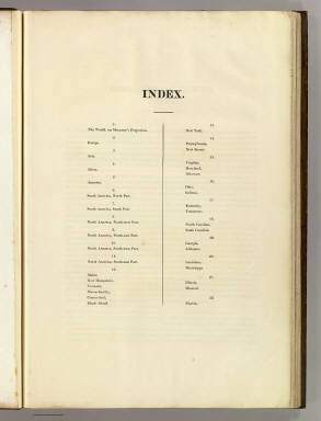
Index Page
|
|
Obj Height cm:
|
61
|
|
Obj Width cm:
|
41
|
|
Country:
|
United States
|
|
Full Title:
|
(Index Page to) A New American Atlas Containing Maps Of The Several States of the North American Union, Projected and drawn on a Uniform Scale from Documents found in the public Offices of the United States and State Governments, and other Original and Authentic Information, By Henry S. Tanner ... Philadelphia: Published By H.S. Tanner. 1825. (title page only) Writing Drawn and Engraved by Joseph Perkins. Barralet del. Humphrys sc.
|
|
List No:
|
2755D
|
|
Series No:
|
4
|
|
Publication Author:
|
Tanner, Henry S.
|
|
Pub Date:
|
1825
|
|
Pub Title:
|
A New American Atlas Containing Maps Of The Several States of the North American Union, Projected and drawn on a Uniform Scale from Documents found in the public Offices of the United States and State Governments, and other Original and Authentic Information, By Henry S. Tanner ... Philadelphia: Published By H.S. Tanner. 1825. (title page only) Writing Drawn and Engraved by Joseph Perkins. Barralet del. Humphrys sc.
|
|
Pub Reference:
|
cf P3669.
|
|
Pub Note:
|
2nd edition, maps and title page dated 1825, except S.A. 1823. Like P3669, except S.A. dated 1823 and N.A. dated 1825. Fine copy with extra large sheets bound in full tree calf edged in gilt - the most beautiful and elegant binding we have seen of an American Atlas, stamped "Davis, Binder - Philada." The spine is titled "American Atlas" on a red leather label in gilt. Memoir dated 1825, with slight changes from the 1823 memoir. The index sheet is numbered 1-22 in two columns, vs in one column in the 1823 edition and in two columns numbered 1-17 in the 1833 editions. The maps of the World and America have Arctic discoveries not shown in earlier editions, as does the N.A. map which also shows the Russian Alaska boundary of 1824. The state maps have various updates from the earlier issues (mostly adding counties) although three (Maine etc., Penn., N. & S. Carolina) have 1825 dates with no obvious changes from the earlier issues. See our table comparing all five editions map by map. According to Wolter (Mountains & Rivers article) the 1825 S.A. map has a more elaborate mountains and rivers diagram than any earlier issues. This issue of the atlas can be truly called an edition - all the maps have 1825 dates and the geography is current; the 1823 parts issue is also an edition. Later editions were compilations - some maps were updated, others were not or were taken from out of date issues. Full color.
|
|
Pub List No:
|
2755.000
|
|
Pub Type:
|
World Atlas
|
|
Pub Maps:
|
18
|
|
Pub Height cm:
|
62
|
|
Pub Width cm:
|
43
|
|
Image No:
|
2755D
|
|
Download 1:
|
|
|
Download 2:
|
|
|
Authors:
|
Tanner, Henry S.
|
|
Collection:
|
Rumsey Collection
|