COLLECTION NAME:
David Rumsey Historical Map Collection
Record
Author:
Davis, Charles Henry
Date:
1866
Short Title:
No.I. General map of the American Isthmuses
Publisher:
Bowen & Co.
Publisher Location:
Philadelphia
Publisher Location:
Washington
Publisher:
U.S.
Publisher Location:
Philadelphia
Publisher Location:
Washington
Type:
Book Map
Obj Height cm:
51
Obj Width cm:
61
Scale 1:
None shown
Note:
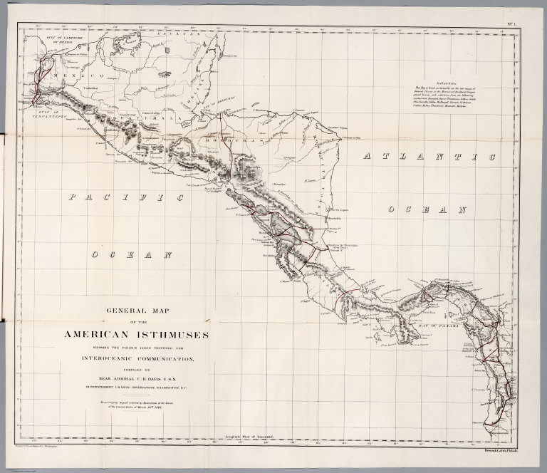
Uncolored map, folded to 23x15. Includes authority note. Relief shown by hachures. Shows rivers, major cites and towns, ports, canals and railroads.
World Area:
Central America
Subject:
Canals
Subject:
Railroad
Full Title:
No.I. General map of the American Isthmuses showing the various lines proposed for Interoceanic communication, compiled by Rear Admiral C.H. Davis, U.S.N. Superintendent U.S. Naval Observatory, Washington D.C. "To accompany Report ordered by resolution of the Senate of the United States of March 19th. 1866". Drawn by Louis Waldecker, Washington. Bowen & Co. Lith. Philada.
List No:
1789.002
Page No:
I
Series No:
2
Engraver or Printer:
Bowen & Co.
Engraver or Printer:
Hergesheimer, E.
Engraver or Printer:
Fitzroy, Admiral.
Engraver or Printer:
Waldecker, Louis.
Engraver or Printer:
Gisborne, Lionel.
Engraver or Printer:
Childs, O.W.
Engraver or Printer:
Garella, Napoleon.
Engraver or Printer:
Hughes, G.W.
Engraver or Printer:
Kelley, Frederick M.
Engraver or Printer:
Butler, Cyrus.
Engraver or Printer:
Merrill, Luke T.
Publication Author:
Davis, Charles Henry
Pub Date:
1866
Pub Title:
Report on Interocean Railroads & Canals between the waters of the Atlantic and Pacific Oceans. {Senate} 39th Congress, 1st Session. Ex. Doc. No. 62.
Pub Note:
Early issue. Maps are uncolored. Also includes profile views of potential canal sites. All maps bound in cloth covered boards with title on the spine. "Interoceanic railroads and canals. 1866".
Pub List No:
1789.000
Pub Type:
Survey Book
Pub Maps:
11
Pub Height cm:
23
Pub Width cm:
15
Image No:
1789002
Authors:
Davis, Charles Henry