COLLECTION NAME:
David Rumsey Historical Map Collection
Record
Author:
Kensett, T.
Author:
Shelton, W.
Date:
1813
Short Title:
Improved Map of the United States
Publisher:
Shelton & Kensett
Publisher Location:
Cheshire
Type:
Separate Map
Obj Height cm:
47
Obj Width cm:
55
Scale 1:
6,000,000
Note:
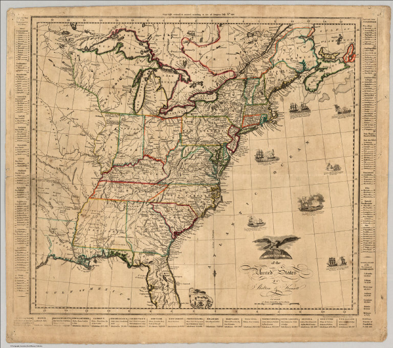
Scarce War of 1812 map. Seven vignettes show important sea battles of the War of 1812. Information on the Post roads, other routes, population of states and territories is given in the borders. A curious note regarding fishing and grapes appears in northern Illinois - seems to be unique to this map. A later reissue of this map was put out in 1825 by Lewis Robinson (see Ristow 271). The map is not very up to date regarding political changes - it does not show Missouri Territory or Louisiana (both 1812). The copyright appears at the top of the map - July 6, 1813. It is engraved by A. Doolittle of New Haven and Kensett of Cheshire. Karpinski 13 is an 1812 Map of the United States and Canada by Kensett and Doolittle, based on surveys by Tardieu, and somewhat smaller in size. Outline color by state. Borders contain tables of distance on the Great Post Road from Pasamaquoddy (ME) to St. Mary's (GA), on the Post Road from Albany (NY) to Montreal ; also population and products of states. Relief shown pictorially and by hachures.
Reference:
P-Maps 878; Ristow p271; Karpinski 24.
Country:
United States
Event:
War Of 1812
Full Title:
An Improved Map of the United States By Shelton & Kensett. Copy right secured & entered according to Act of Congress July 6th 1813. Engraved by A. Doolittle New Haven & T. Kensett Cheshire.
List No:
2956.000
Series No:
1
Engraver or Printer:
Doolittle, A.
Publication Author:
Kensett, T.
Publication Author:
Shelton, W.
Pub Date:
1813
Pub Title:
An Improved Map of the United States By Shelton & Kensett. Copy right secured & entered according to Act of Congress July 6th 1813. Engraved by A. Doolittle New Haven & T. Kensett Cheshire.
Pub Reference:
P-Maps 878; Ristow p271; Karpinski 24.
Pub Note:
Scarce War of 1812 map. Seven vignettes show important sea battles of the War of 1812. Information on the Post roads, other routes, population of states and territories is given in the borders. A curious note regarding fishing and grapes appears in northern Illinois - seems to be unique to this map. A later reissue of this map was put out in 1825 by Lewis Robinson (see Ristow 271). The map is not very up to date regarding political changes - it does not show Missouri Territory or Louisiana (both 1812). The copyright appears at the top of the map - July 6, 1813. It is engraved by A. Doolittle of New Haven and Kensett of Cheshire. Karpinski 13 is an 1812 Map of the United States and Canada by Kensett and Doolittle, based on surveys by Tardieu, and somewhat smaller in size. Outline color by state.
Pub List No:
2956.000
Pub Type:
Separate Map
Pub Height cm:
47
Pub Width cm:
55
Image No:
2956000
Authors:
Shelton, W.; Kensett, T.
