|
REFINE
Search Results: All Fields similar to 'United and States and Census and Office'Author
Norman, William, -1807
Full Title
(Covers to) The American Pilot.
List No
14485.001
Note
Covers to The American Pilot. Folio. Rebound in half calf over boards.
Author
Norman, William, -1807
Full Title
(Advertisement to) Charts : Published and sold by William Norman, no.75, Newbury Street. South End, Boston.
List No
14485.002
Note
Broadside of charts available for sale by publisher. Charts include: The American Pilot. -- The West-India Pilot. -- Single Charts. With three engraved vignettes. Appears pasted on verso of front cover.
Author
[Norman, William, -1807, Carleton, Osgood, 1742-1816]
Full Title
(Title Page to) The American Pilot : Containing the navigation of the sea coast of North America, from the streights of Belle Isle to Cayenne, including the island and banks of Newfoundland, the West India islands, and all the islands on the coast. With particular directions for sailing to, and entering the principal harbours, rivers, &c. Describing also the capes, head lands, rivers, bays, roads, havens, harbours, straits, rocks, sands, shoals, banks, depths of water, and anchorage. Shewing the courses and distances from one place to another, the ebbing of the sea, the setting of the tides and currents, &c. With many other things necessary to be know in navigation. Likewise necessary directions for those who are not fully acquainted with the use of charts. Boston September 10th. 1794. Teacher of the Mathematics. Boston. Printed and sold by Wm. Norman at his office no.75 Newbury Street MDCCXCIIII. Where may be had Huddards St. Georges Channel - Thompsons North Sea - British Channel - Bay of Biscay - Coast of Spain and Portugal - Mediteranean Sea - Nantucket Harbour.
List No
14485.003
Note
Engraved title page to The American Pilot. Includes a description of contents, certificate of accuracy, statement of responsibility, and imprint. With a of the Great Seal of the United States. With an inscription underneath the title: Daniel Anthony Junior. "Published according to Act of Congress."
Author
[Norman, William, -1807, Carleton, Osgood, 1742-1816]
Full Title
(Text Page to) Directions: for sailing along the coast of North America. (1)
List No
14485.004
Note
Descriptions of navigation routes. Includes sections: Directions for sailing into Halifax Harbour. -- Narraganset Bay. With remarks by Osgood Carleton. Spans three unnumbered pages.
Author
[Norman, William, -1807, Dunbibin, Daniel]
Full Title
Text: Directions: for sailing along the coast of North America. (2)
List No
14485.005
Note
Descriptions of navigation routes. Includes sections: Instructions for sailing into Delaware Bay. -- Directions for sailing along the coast of North and part of South Carolina, by the late Daniel Dunbibin, Esq. -- Directions for Cape Hattereras, &c. Spans three unnumbered pages.
Author
Norman, William, -1807
Full Title
(Text Page to) Directions: for those who are not fully acquainted with the use of charts.
List No
14485.006
Note
Descriptions of navigation techniques. Includes sections: To find how any place bears from the ship. -- To find the distance of any place from the ship. With illustrations representing land form outlines: The making of the land on the coast of America. Spans four unnumbered pages.
Author
[Norman, William, -1807, Pinkham, Paul, 1736-1799]
Full Title
A chart of Nantucket Shoals surveyed by Capt. Paul Pinkham. Boston. Published & sold by John Norman, no.75, Newbury Street, Feb. 16th, 1791.
List No
14485.007
Note
Nautical chart representing the Nantucket Shoals. With one inset map: Plymouth Bay. Shows islands, cities, bodies of water, drainage, coastlines, bays, ports, anchorage, shoals, rocks and depths, given in fathoms. Features pictorial representations of buildings, including windmills and a light house. Includes rhumb lines, latitudinal and longitudinal lines, as well as a compass rose with north oriented toward top of sheet, a bar scale given in miles, and arrows referring to the directions of water currents. With historical text. Black and white engraving. Chart is 50 x 77 cm, on double sheet 54 x 83 cm. "According to Act of Congress."
Author
Norman, William, -1807
Full Title
[Chart of Suriname River and vicinity.]
List No
14485.008
Note
Nautical chart representing the Surinam [Suriname] River and vicinity. Shows rivers, cities, bodies of water, drainage, coast line, bays, ports, shoals, and depths, given in fathoms. Includes rhumb lines, latitudinal and longitudinal lines, as well as a compass rose with north oriented toward top of sheet, and arrows referring to the directions of water currents. Black and white engraving. Chart is 52 x 41 cm, on sheet 55 x 45 cm. Handwritten annotation in graphite in bottom right corner: Dutch Guiana.
Author
[Norman, William, -1807, Carleton, Osgood, 1742-1816]
Full Title
A new general chart of the West Indies from the latest marine journals and surveys, regulated and ascertained by astronomical observations ... Printed & sold by W. Norman
List No
14485.009
Note
Nautical chart representing the West Indies. Shows islands, cities, bodies of water, drainage, coastlines, bays, and ports. Includes rhumb lines, latitudinal and longitudinal lines, scale of nautical leagues, as well as a compass rose with north oriented toward top of sheet. Black and white engraving. "I the subscriber do certify that I have carefully examined this chart copied from a London publication agreeable to Act of Parliament and find it a true and accurate copy of the original. Osgood Carleton, Teacher of Navigation and other Branches of the Mathematics. Boston. Decr. 28th 1789." Chart is 69 x 99 cm, on fold-out sheet 71 x 101 cm.
Author
Norman, William, -1807
Full Title
A chart of South Carolina and Georgia.
List No
14485.010
Note
Nautical chart representing the coasts of South Carolina and Georgia. With one ancillary map: A chart of the bar and harbour of Charles Town [Charlestown], South Carolina. Maps show islands, cities, bodies of water, drainage, coast line, bays, ports, shoals, and depths, given in fathoms. Includes rhumb lines, latitudinal and longitudinal lines. Chart of South Carolina and Georgia includes a compass rose with north oriented toward top of sheet; Chart of Charles Town [Charlestown] includes a compass rose with north oriented toward right of sheet. Black and white engraving. Chart is 52 x 42 cm, on sheet 54 x 45 cm.
Author
[Norman, William, -1807, Dunbibin, Daniel]
Full Title
Chart of the coast of America from Cape Hateras to Cape Roman from the actual surveys of D.L. Dunbibin, Esqr.
List No
14485.011
Note
Nautical chart representing the coast line of North and South Carolina from Cape Hateras [Cape Hatteras] to Cape Roman [Cape Romain]. Shows islands, cities, bodies of water, drainage, coast line, bays, ports, shoals, and depths, given in fathoms. Includes rhumb lines, latitudinal and longitudinal lines, a compass rose with north oriented toward top of sheet, arrows referring to the directions of water currents, as well as a bar scale given in English leagues. With pictorial illustrations of trees, buildings, ships, and a sea monster. Black and white engraving. Chart is 51 x 80 cm, on double sheet 55 x 84 cm.
Author
[Norman, William, -1807, Carleton, Osgood, 1742-1816]
Full Title
A new and accurate chart of the Bay of Chesapeak including Delaware Bay with all the shoals, channels, islands, entrances, soundings, & sailing marks as far as the navigable part of the rivers Patowmack Patapsco & N. East ... Printed & sold by W. Norman at his shop no.75 Newbury Street.
List No
14485.012
Note
Nautical chart representing Bay of Chesapeak [Chesapeake Bay] and Delaware Bay. Shows state boundaries, islands, cities, bodies of water, drainage, coastlines, bays, ports, shoals, and depths, given in fathoms. Includes rhumb lines, latitudinal and longitudinal lines, bar scale of miles and leagues, as well as a compass rose with north oriented toward top of sheet. Descriptive text throughout, for instance: Coarse red & white sand with black specks & broken shells. With tables, including: A tide table for Delaware Bay and River. Black and white engraving. "Certificate. I have carefully compared this chart with the originals and find it an accurate copy, and though the latitudes of places near the sources of some of the rivers are a few minutes too great, yet the general courses &c. are as true as any chart now extant, and the largeness of the scale gives it the preference. Osgood Carleton." Chart is 104 x 84 cm, on fold-out sheet 105 x 85 cm.
Author
[Norman, William, -1807, Carleton, Osgood, 1742-1816]
Full Title
Chart from New York to Timber Island including Nantucket Shoals from the latest surveys ... Printed & sold by J. Norman no.75 Newbury Str, Boston.
List No
14485.013
Note
Nautical chart representing the New York state coast to Timber Island, Maine, including Nantucket Shoals. Shows county boundaries, islands, cities, bodies of water, drainage, coastlines, bays, ports, shoals, and depths, given in fathoms. Includes rhumb lines, latitudinal and longitudinal lines, a scale of nautical miles, as well as a compass rose with north oriented toward top of sheet. With inset map: Plymouth Bay. "I have carefully examined this chart and find it to agree with Holland's Surveys [of] the shoals by one well authenticated by 13th Pilots. Osgood Carleton. Teacher of Navigation and other Branches of the Mathematics." Chart is 121 x 188 cm, on fold-out sheet 125 x 191 cm.
Author
Norman, William, -1807
Full Title
[Chart of the coast of Maine.]
List No
14485.014
Note
Nautical chart representing the coast line of Maine. Shows islands, cities, topography, bodies of water, drainage, coastline, bays, ports, shoals, and depths, given in fathoms. Relief shown with hachures. Includes rhumb lines, latitudinal and longitudinal lines, as well as a compass rose with north oriented toward top of sheet. Black and white engraving. Handwritten annotation, in graphite, at bottom right margin: Coast of Maine. Chart is 52 x 84 cm, on double sheet 55 x 84 cm.
Author
Norman, William, -1807
Full Title
[Chart of the Bay of Fundy.]
List No
14485.015
Note
Nautical chart representing the Bay of Fundy. Shows islands, cities, topography, bodies of water, drainage, coastline, bays, ports, shoals, and depths, given in fathoms. Includes latitudinal and longitudinal lines, as well as a compass rose with north oriented toward top of sheet. Black and white engraving. Chart is 53 x 42 cm, on sheet 55 x 45 cm.
Author
Norman, William, -1807
Full Title
[Chart of part of Newfoundland.]
List No
14485.016
Note
Nautical chart representing part of Newfoundland, including the Gulf of St. Lawrence and Strait of Belle Isle. Shows islands, cities, topography, bodies of water, drainage, coastline, bays, ports, shoals, and depths, given in fathoms. Includes latitudinal and longitudinal lines, as well as a compass rose with north oriented toward top of sheet. Black and white engraving. Chart is 52 x 42 cm, on sheet 55 x 45 cm.
Author
[Norman, William, -1807, Cook, James, active 1762-1775; Chabert; Fleurieu]
Full Title
A chart of the banks of Newfoundland drawn from a great number of hydrographical surveys, chiefly from those of Chabert, Cook and Fleurieu, connected and ascertained by astronomical observation.
List No
14485.017
Note
Nautical chart representing the banks of Newfoundland. Shows state boundaries, islands, cities, bodies of water, drainage, coastlines, bays, ports, shoals, and depths, given in fathoms. Features routes of voyages with historical notes. Includes latitudinal and longitudinal lines, a scale of nautical leagues, as well as a compass rose with north oriented toward top of sheet. With table: Astronomical observations on which this chart is grounded. Black and white engraving. Chart is 49 x 82 cm, on double sheet 54 x 86 cm.
Author
Woodbridge, William C.
Full Title
(Text Page to) Table Of The Population Of The United States. (to accompany) Modern Atlas On A New Plan; To Accompany The System Of Universal Geography, By William Channing Woodbridge ... Exhibiting In Connection With The Outlines Of Countries, The Prevailing Religions, Forms Of Government, And Degrees Of Civilization; The Comparative Size Of Towns, Rivers And Mountains; And The Climates And Productions Of The Earth ... District Of Connecticut, ss. Be It Remembered, That on the twenty-second day of June, in the forty-eighth year of the Independence of the United States of America, William Channing Woodbridge ... and Emma Willard ... have deposited in this Office the title of a book ... Charles A. Ingersoll, Clerk of the District of Connecticut. Hartford: Oliver D. Cooke & Sons, Publishers.
List No
4602.008
Note
Table includes The Population of the United States, arranged in classes; from the census of 1820. Bound in quarter leather tan boards with the above title, the table of contents and a decorative border printed in black. Prime meridian is Greenwich.
Author
[Johnson, A.J., Johnson, D. Griffing]
Full Title
Johnson's New Illustrated & Embellished County Map Of The Republics Of North America With The Adjacent Islands & Countries, Compiled Drawn & Engraved From U. States Land & Coast Surveys, British Admiralty & other Reliable Sources. By D. Griffing Johnson, New York & Washington. 1859. Entered ... 1856 by D.G. & A.J. Johnson ... New York. Map Designed by A.J. Johnson. Engraved by D.G. Johnson, J.H. Goldthwait, W.S. Barnard, Wm. Wright, G. Rae Smith, F.H. King, James Duthie, J.L. White. (inset) Johnson's Map Of The World on Mercator's Projection ...
List No
4012.000
Note
Entered in 1856 and first issued in 1857. With an inset map of the World, and views of the U.S. Capital and the Mormon Temple at Salt Lake City, tables of Distances and Statistics from the Census of 1850, and a Note and list of Authorities which reads in part "The part of this Map, between the Mississippi River and Pacific Ocean, was taken (with the consent of Capt. A.A. Humphreys) principally from a map compiled from the following authorities by Lieut. G.K. Warren, Topl Engrs...In the Office of Pacific Rail Road Surveys, War Department." The map referred to must be the 1855 edition (see our copy) of Warren's General Map for the Pacific Railroad Reports. The list of Authorities is almost identical to the list on that map. Also, the map details of the west used in Johnson's map follow the 1855 edition in scope. Karrow lists many issues of this map from 1857 to 1861, with the views varying in each issue, and with Colton taking over as publisher in 1860. See our late Colton edition of 1890 (our #5150). With black top and bottom roller. Full color by county or territory in the U.S. and by state in Central America. Edged in dark blue silk.
Author
Mitchell, Samuel Augustus
Full Title
A New Map of Arkansas with its Counties, Towns, Post Offices, &c. Published By Charles Desilver, No. 714 Chestnut Street, Philadelphia. Entered according to Act of Congress in the year 1856 by Charles Desilver in the Clerk's office if the District Court of the Eastern District of Pennsylvania. 26.
List No
4557.026
Note
Counties tinted in color. Meridian Washington. Relief shown with hachures. Table of Population of Arkansas by the Census of 1850.
Author
[J.C. Clark & Co., Hutawa, Julius]
Full Title
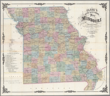
(Covers to) Clark’s New Sectional Map of Missouri compiled & engraved from the United States land surveys and other reliable sources.
List No
15110.001
Author
[J.C. Clark & Co., Hutawa, Julius]
Full Title
Clark’s New Sectional Map of Missouri compiled & engraved from the United States land surveys and other reliable sources.
List No
15110.002
Author
[Colton, J. H., Johnson, A.J.]
Full Title
Johnson's New Illustrated & Embellished County Map Of The Republics Of North America With The Adjacent Islands & Countries, Compiled Drawn & Engraved From U. States Land & Coast Surveys, British Admiralty & other Reliable Sources. Under the Direction of A.J. Johnson. Published by J.H. Colton, 172, William Street, New York, Edition For Johnson & Browning. Richmond VA. 1860. Entered ... 1860 by J.H. Colton ... New York. Map Designed by A.J. Johnson. Engraved by D.G. Johnson, J.H. Goldthwait, W.S. Barnard, Wm. Wright, G. Rae Smith, F.H. King, James Duthie, J.L. White. (inset) Map Of The World on Mercator's Projection ...
List No
5811.000
Note
Entered in 1856 and first issued in 1857. With an inset map of the World, and views of the U.S. Capital and state symbols around an eagle, tables of Distances and Statistics from the Census of 1850. Compared to the 1859 edition (our 4012.000) Colona, Jefferson, and Shoshone are added as proposed states in the west, one of the only maps we have seen to show all three. Also, the imprint of Johnson and Browning, Richmond Virginia is very unusual and probably one of the last north south publishing collaborations on the eve of the Civil War. There is Note and list of Authorities which reads in part "The part of this Map, between the Mississippi River and Pacific Ocean, was taken (with the consent of Capt. A.A. Humphreys) principally from a map compiled from the following authorities by Lieut. G.K. Warren, Topl Engrs...In the Office of Pacific Rail Road Surveys, War Department." The map referred to must be the 1855 edition (see our copy) of Warren's General Map for the Pacific Railroad Reports. The list of Authorities is almost identical to the list on that map. Also, the map details of the west used in Johnson's map follow the 1855 edition in scope. Karrow lists many issues of this map from 1857 to 1861, with the views varying in each issue, and with Colton taking over as publisher in 1860, as in this copy. See our late Colton edition of 1890 (our #5150). With black top and bottom roller. Full color by county or territory in the U.S. and by state in Central America. Edged in dark blue silk.
Author
[Hergesheimer, Edwin, U.S. Coast and Geodetic Survey]
Full Title
Map Showing The Distribution Of The Slave Population Of The Southern States Of The United States Compiled from the Census Of 1860.
List No
10166.000
Note
"Entered according to Act of Congress, A.D. 1861 by Henry S. Graham." "Sold for the benefit of the sick and wounded soldiers of the U.S. Army." "Census Office, Department of the Interior, Washington, Sept. 9th, 1861. After a careful examination of the above very interesting map I am prepared to state that it not only furnishes the evidences of great care in its execution, but can be relied on as corresponding with the official returns of the 8th Census. [Signed in facsimile] Jos. C.G. Kennedy, Superintendent." Map indicates by gray patterns, the percentage of slaves in each county. "It should be observed, that several counties appear comparatively light. This arises from the preponderance of whites and free blacks in the large towns in those counties. . The figures in each county represent the percentage of slaves." "Scale of shade" printed in lower right corner. Includes population table based on census of 1860. Susan Schulten "The 1860 Census was the last time the federal government took a count of the South’s vast slave population. Several months later, the United States Coast Survey—arguably the most important scientific agency in the nation at the time—issued two maps of slavery that drew on the Census data, the first of Virginia and the second of Southern states as a whole. Though many Americans knew that dependence on slave labor varied throughout the South, these maps uniquely captured the complexity of the institution and struck a chord with a public hungry for information about the rebellion. The map uses what was then a new technique in statistical cartography: Each county not only displays its slave population numerically, but is shaded (the darker the shading, the higher the number of slaves) to visualize the concentration of slavery across the region. The counties along the Mississippi River and in coastal South Carolina are almost black, while Kentucky and the Appalachians are nearly white." .
Author
Farmer, John, 1798-1859
Full Title
Map of the states of Michigan and Wisconsin : embracing a great part of Iowa, Illinois & Minnesota; and the whole mineral region, with charts of the lakes; exhibiting the sections, the soundings, the geological formations and the general topography. Compiled from the topographical departments, from the Office of the United States Lake Surveys, from the latest geological and linear surveys, and from various authentic and reliable sources ; projected, engraved by John Farmer, C. E. Detroit, Michigan. Published by R. Farmer & Co. 1861. (7 insets). Entered according to act of Congress ... 29th day of September, A.D. 1858 ... And reentered ... 21st day of Janu. A.D. 1861 by R. Farmer and Co.
List No
11273.000
Note
This may be the only large wall map that Farmer made. Outline hand color wall map. With 7 insets: Geological map of part of Minnesota. (with) Map and profile of Canal at Sault Ste. Mary. (with) Map of Beaver Isles. (with) A geological map of Isle Royale, Lake Superior. (with) Connection of the private claims with the public surveys at Ptc. Ste. Ignace. (with) Chart of Port Colier. (with) Chart of Detroit River. Relief shown by hachures, shadings and spot heights. Bathymetry shown by soundings in feet. Shows state boundaries, swamp lands, Indian reservations, cities and towns. Includes: Geological references for Wisconsin, Iowa and Minnesota, Reference table, Census of Michigan counties for 1837-1860 and text.
Author
Mitchell, Samuel Augustus
Full Title
A New Map of the United States of America by J.H. Young. Philadelphia, Published By Charles Desilver, No. 1229 Chesnut Street. Entered according to Act of Congress in the year 1860 by Charles Desilver in the Clerk's office if the District Court of the Eastern District of Pennsylvania. 6. Engraved by J.L. Hazzard & E. Yeager.
List No
6727.009
Note
Folded sheet. Tinted in color and outline by state. The inset maps of the Gold Region of California, and District of Columbia that appear in the 1859 edition map are replaced with tables from the 1860 census. Many new states and territories are shown. Meridians Washington and Greenwhich. Relief shown by hachures.
Author
Mitchell, Samuel Augustus
Full Title
A New Map of Arkansas with its Counties, Towns, Post Offices, &c. Published By Charles Desilver, No. 714 Chesnut Street, Philadelphia. Entered according to Act of Congress in the year 1859 by Charles Desilver in the Clerk's office if the District Court of the Eastern District of Pennsylvania. 26.
List No
6727.028
Note
Counties tinted in color. Meridian Washington. Relief shown with hachures. Table of Population of Arkansas by the Census of 1850.
Author
Turnbull, Benjamin Corbett
Full Title
Map Of San Francisco Exhibiting the General Proportion of Brick And Stone Frame Buildings Throughout the City. San Francisco, 1874.
List No
10545.000
Note
Much of the original blue coloring survived but the yellow and the red were largely faded before restoration. The yellow and red colors have been filled in based on information on the map itself and other sources of information on building types.
Author
[United States. Census Office, Walker, Francis Amasa, 1840-1897]
Full Title
(Covers to) Statistical atlas of the United States based on the results of the ninth census 1870 with contributions from many eminent men of science and several departments of the government. Compiled under authority of Congress by Francis A. Walker, M.A., Superintendent of the 9th Census, professor of political economy and history, Sheffield Scientific School of Yale College. Julius Bien, Lith., 1874.
List No
3566A
Note
Bound in half leather brown cloth covered boards with "Statistical atlas of the United States. Francis A. Walker. 1874." stamped in gold on a leather label. Spine reads "Statistical atlas."
Author
[United States. Census Office, Walker, Francis Amasa, 1840-1897]
Full Title
(Title Page to) Statistical atlas of the United States based on the results of the ninth census 1870 with contributions from many eminent men of science and several departments of the government. Compiled under authority of Congress by Francis A. Walker, M.A., Superintendent of the 9th Census, professor of political economy and history, Sheffield Scientific School of Yale College. Julius Bien, Lith., 1874.
List No
3566B
Note
The first statistical atlas published by the U.S. government. With printed color. Bound in half leather brown cloth covered boards with "Statistical atlas of the United States. Francis A. Walker. 1874." stamped in gold on a leather label. Spine reads "Statistical atlas."
Author
[United States. Census Office, Walker, Francis Amasa, 1840-1897]
Full Title
(Index to) Statistical atlas of the United States based on the results of the ninth census 1870 with contributions from many eminent men of science and several departments of the government. Compiled under authority of Congress by Francis A. Walker, M.A., Superintendent of the 9th Census, professor of political economy and history, Sheffield Scientific School of Yale College. Julius Bien, Lith., 1874.
List No
3566C
Note
"Index to maps and charts."
Author
[Steinwehr, A. von (Adolph), 1822-1877, United States. Census Office, Walker, Francis Amasa, 1840-1897]
Full Title
Map of the river systems of the United States compiled by A. von Steinwehr. To which are added certain statistics compiled from the returns of population and industry at the ninth census 1870 by Francis A. Walker. (Julius Bien, Lith., 1874)
List No
3566.001
Note
Colored lithograph map. Shows drainage basins with area in square miles; rainfall in inches; corn, wheat, tobacco, rice, sugar and cotton production; steam power and water power employed in manufactures.
Author
[Brewer, William H., United States. Census Office]
Full Title
Map showing in five degrees of density the distribution of woodland within the territory of the United States, 1873. Compiled by Wm. H. Brewer. (Julius Bien, Lith., 1874)
List No
3566.002
Note
Colored lithographed map.
Author
[Henry, Joseph, 1797-1878, Schott, Charles A. (Charles Anthony), 1826-1901, United States. Census Office]
Full Title
Rain chart of the United States. Showing the distribution by isohyetal lines of the mean precipitation in rain and melted snow for the year. Constructed under the direction of Prof. Joseph Henry, Sec'y. Smithsonian Institution from materials collected and observations made for the Smithsonian Institution by Chas. A. Schott, Asst., U.S. Coast Survey, with additions to 1872. (Julius Bien, Lith., 1874)
List No
3566.003
Note
Colored lithographed map. "Re-engraved and printed for the Statistical atlas of the United States, with permission ..." "The precipitation on the mountain ranges west of longitude 1040, though often considerable is too imperfectly known to be delineated."
Author
[United States. Army. Signal Service, United States. Census Office]
Full Title
U.S. Signal Service chart showing the frequency of storm centres. Number of storm centres passing over each point deduced from the average of the two years March 1871 to February 1873 inclusive. Compiled from data collected at the Office of the Chief Signal Officer of the Army. (Julius Bien, Lith., 1874)
List No
3566.004
Note
Lithographed map. Data shown only for area east of 100th meridian.
Author
[Henry, Joseph, 1797-1878, Schott, Charles A. (Charles Anthony), 1826-1901, United States. Census Office]
Full Title
Temperature chart of the United States. Showing the distribution by isothermal lines of the mean temperature for the year. Constructed under the direction of Prof. Joseph Henry, Sec'y. Smithsonian Institution by Chas. A. Schott, Asst., U.S. Coast Survey in October, 1872. (Julius Bien, Lith., 1874)
List No
3566.005
Note
Colored lithographed map. "Re-engraved and printed for the Statistical atlas of the United States, with permission ..."
Author
[United States. Army. Signal Service, United States. Census Office]
Full Title
U.S. Signal Service chart showing the mean temperature. At 4.35 P.M. of the hottest week of 1872, in red, and at 7.35 A.M. of the coldest week of 1872 and 1873, in blue. Compiled from data collected at the Office of the Chief Signal Officer of the Army. (Julius Bien, Lith., 1874)
List No
3566.006
Note
Colored lithographed map.
Author
[United States. Army. Signal Service, United States. Census Office]
Full Title
U.S. Signal Service chart, showing annual means of barometer and total movement of air with resultants from June 1872 to May 1873 inclusive. Compiled from data collected at the Office of the Chief Signal Officer of the Army. (Julius Bien, Lith., 1874)
List No
3566.007
Note
Colored lithographed map.
Author
[Guyot, A. (Arnold), 1807-1884, Schott, Charles A. (Charles Anthony), 1826-1901, United States. Census Office]
Full Title
Hypsometric sketch of the United States. The level curves of 400 and 800 feet of elevation constructed by A. Guyot. The level curves of 2000, 4000 and 8000 feet of elevation constructed by Chas. A. Schott, Asst., U.S. Coast Survey. (Julius Bien, Lith., 1874)
List No
3566.008
Note
Colored lithographed map. Relief shown by hachures and altitude tints. "Reproduced from the 'Vital Statistics,' ninth census, 1870. Shore line from the Coast Survey, mountains from government surveys."
Author
[Hitchcock, Charles H. (Charles Henry), 1836-1919, United States. Census Office, Walker, Francis Amasa, 1840-1897]
Full Title
Map of the coal fields of the United States, compiled from state reports and data specially furnished by Prof. W.B. Rogers, E.T. Cox, A.H. Worthen, S.S. Lyon, Richard Owen, A.B. Roessler, R.P. Rothwell, Jas. MacFarlane, G.C. Swallow and W.C. Kerr, by Charles Hitchcock. To which are added the statistics of coal product for the years ending June 1st compiled from the statistics of industry, ninth census, 1870 by Francis A. Walker. (with) Map of the first and second anthracite coal fields of Pennsylvania. (Julius Bien, Lith., 1874)
List No
3566.009
Note
Hand colored lithographed map. Shows formations beneath the coal measures, lower coal measures, upper coal measures, anthracite basins, Triassic coal and alluvium.
Author
[Blake, William P. (William Phipps), 1826-1910, Hitchcock, Charles H. (Charles Henry), 1836-1919, United States. Census Office]
Full Title
Geological map of the United States compiled by C.H. Hitchcock and W.P. Blake from sources mentioned in the text. 1874. Lith. by J. Bien, N.Y.
List No
3566.010
Note
Colored lithographed map. Shows 9 geologic units.
Author
[Stocking, S. W., United States. Census Office]
Full Title
Map showing the acquisition of territory and its distribution among political divisions, 1776-1874. Compiled by S.W. Stocking. (with) Alaska. (Julius Bien, Lith., 1874)
List No
3566.011
Note
Colored lithographed map with inset.
Author
[United States. Census Office, Walker, Francis Amasa, 1840-1897]
Full Title
The progress of the nation, 1790-1820. Maps showing in five degrees of density the distribution within the territory east of the 100th meridian of the population of the United States, excluding Indians not taxed. Compiled from the returns of the population at the first, second, third and fourth censuses of the United States, 1790-1800-1810-1820 by Francis A. Walker. (Julius Bien, Lith., 1874)
List No
3566.012
Note
Four colored lithographed maps. Shows also center of population.
Author
[United States. Census Office, Walker, Francis Amasa, 1840-1897]
Full Title
Map showing, in five degrees of density, the distribution, within the territory east of the 100th Meridian, of the population of the United States, excluding Indians not taxed. Compiled from the returns of population at the fifth census of the United States 1830 ... sixth census of the United States 1840, by Francis A. Walker. (Julius Bien, Lith., 1874)
List No
3566.013
Note
Two colored lithographed maps. In upper margin: The progress of the nation, 1830 ... 1840. Includes center of population.
Author
[United States. Census Office, Walker, Francis Amasa, 1840-1897]
Full Title
Map showing in five degrees of density, the distribution, within the territory east of the 100th Meridian, of the population of the United States, excluding Indians not taxed. Compiled from the returns of population at the seventh census by Francis A. Walker. (Julius Bien, Lith., 1874)
List No
3566.014
Note
Colored lithographed map. In upper margin: The progress of the nation 1850. Includes center of population.
Author
[United States. Census Office, Walker, Francis Amasa, 1840-1897]
Full Title
Map showing in five degrees of density, the distribution, within the territory east of the 100th Meridian, of the population of the United States, excluding Indians not taxed. Compiled from the returns of population at the eighth census by Francis A. Walker. (Julius Bien, Lith., 1874)
List No
3566.015
Note
Colored lithographed map. In upper margin: The progress of the nation 1860. Includes center of population.
Author
[United States. Census Office, Walker, Francis Amasa, 1840-1897]
Full Title
Map showing, in five degrees of density, the distribution, within the territory of the United States, of the constitutional population, i.e., excluding Indians not taxed. Compiled from the returns of population at the ninth census of the United States, 1870. By Francis A. Walker. To which is added a sketch of the principal Indian reservations and ranges from information furnished by the Office of Indian Affairs of date 1871. (Julius Bien, Lith., 1874)
List No
3566.016
Note
Colored lithographed map. Includes center of population.
Author
[United States. Census Office, Walker, Francis Amasa, 1840-1897]
Full Title
Chart showing the principal constitutional elements of the population of each state, as foreign, native, colored, and native white, and as born within or without the state of residence. Compiled from the returns of population at the ninth census 1870. By Francis A. Walker. (Julius Bien, Lith., 1874)
List No
3566.017
Note
Colored lithographed chart.
Author
[United States. Census Office, Walker, Francis Amasa, 1840-1897]
Full Title
Map showing in five degrees of density the distribution of the colored population within the territory of the United States east of the 100th Meridian. Compiled from the returns of population at the ninth census of the United States 1870, by Francis A. Walker. (Julius Bien, Lith., 1874)
List No
3566.018
Note
Colored lithographed map.
Author
[United States. Census Office, Walker, Francis Amasa, 1840-1897]
Full Title
Map showing the proportion of the colored to the aggregate population. Compiled from the returns of population at the ninth census of the United States, 1870. By Francis A. Walker. (Julius Bien, Lith., 1874)
List No
3566.019
Note
Colored lithographed map.
|


![[Chart of the Suriname River and vicinity.]](https://www.davidrumsey.com/rumsey/Size2/RUMSEY~8~1/213/14485008.jpg)


![[Chart of the coast of Maine.]](https://www.davidrumsey.com/rumsey/Size2/RUMSEY~8~1/213/14485014.jpg)
![[Chart of the Bay of Fundy.]](https://www.davidrumsey.com/rumsey/Size1/RUMSEY~8~1/213/14485015.jpg)
![[Chart of part of Newfoundland.]](https://www.davidrumsey.com/rumsey/Size1/RUMSEY~8~1/213/14485016.jpg)