|
Author
[Nolin, Jean Baptiste, 1648-1708, Coronelli, Vincenzo (1650-1718), Du Tralage, Jean Nicolas, -169]
Full Title
Partie Orientale du Canada ou de la Nouvelle France ou sont les Provinces, ou Pays de Sagvenay, Canada, Acadie etc. les Peuples, ou Nations des Etechemins, Iroquois, Attiquameches etc. Avec la Nouvelle Angleterre, la Nouvelle Ecosse, la Nouvelle Yorck, et la Virginie, les Isles de Terre Neuve, de Cap Breton etc. le Grand Banc etc. Dressee sur les Memoires les plus Nouveaux. Par le P. Coronelli Cosmographe de la Serenisme. Rep. de Venise. Corrigée et augmentée par le Sr. Tillemon; et dediée a Monsieur l'Abbé Baudrand. Par son tres humble Serviteur J. B. Nolin. A Paris, Chez J. B. Nolin, sur le Quay de l’Horloge du Palais, proche le Pont Neuf, a l'enseigne de la Place des Victoires. Avec Privilege du Roy. 1689.
List No
14353.048
Note
Map of eastern Canada. Title translates to: Eastern part of Canada or New France, with the Provinces, of Saguenay, Canada, Acadia etc., and the peoples, or nations of Etechemins, Iroquois, Attiquameches etc, and with New England, Nova Scotia, New York, and Virginia, the Isles of Newfoundland, Cape Breton etc. Shows political boundaries, cities, forts, topography, lakes, drainage, coastlines, shoals, islands and sea monsters. Features the territories of indigenous peoples therein. Relief shown pictorially. Includes latitudinal and longitudinal lines, as well as a legend, four bar scales and explanatory notes. Decorative cartouche with indigenous figures, flora and fauna. Black and white engraving with hand-colored borders. Map is 43 x 58 cm, on double sheet 50 x 67 cm. (Plate number handwritten in ink on verso.)
Author
Bowen, Emanuel
Full Title
A new & accurate map of Scotland or North Britain. Drawn from surveys and most approved maps and charts, & regulated by astronl. observns. With several imrovemts. not to be found in any other map extant. By Eman. Bowen. (London: Printed for William Innys, Richard Ware, Aaron Ward, J. and P. Knapton, John Clarke, T. Longman and T. Shewell, Thomas Osborne, Henry Whitridge ... M.DCC.XLVII)
List No
3733.007
Note
Engraved map. Shows forested areas, banks, etc. Relief shown pictorially. Includes inset map of the Shetland Islands, tables of the shires and parliamentary boroughs, and cartographic notes.
Author
Bowen, Emanuel
Full Title
A new and accurate map of Ireland. Laid down from the best authorities extant, and regulated by astronoml. observatns. By Emanl. Bowen. (London: Printed for William Innys, Richard Ware, Aaron Ward, J. and P. Knapton, John Clarke, T. Longman and T. Shewell, Thomas Osborne, Henry Whitridge ... M.DCC.XLVII)
List No
3733.008
Note
Engraved map. Shows forested areas, banks, etc. Relief shown pictorially. Includes geographic notes.
Author
Bowen, Emanuel
Full Title
A new and accurate map of the Seven United Provinces. Compiled from the most approv'd maps & charts and adjusted by astronoml. observations. By Emanl. Bowen. (London: Printed for William Innys, Richard Ware, Aaron Ward, J. and P. Knapton, John Clarke, T. Longman and T. Shewell, Thomas Osborne, Henry Whitridge ... M.DCC.XLVII)
List No
3733.013
Note
Engraved map. Shows forested areas, marshes, banks, etc. Relief shown pictorially. Includes map "A chart of the sea coast of England, Holland, Zeeland and Flanders, shewing the sands, soundings, bearings &c. According to Cn. Collins, also describing some of the usual tracks of sailing from one shore to the other." Includes cartographic note and ornamental cartouche.
Author
Bowen, Emanuel
Full Title
A new & accurate map of Turky in Asia, Arabia &c. Drawn from the best authorities, assisted by the most approved modern maps & charts. The whole being regulated by astronl. observatns. By Eman: Bowen. (London: Printed for William Innys, Richard Ware, Aaron Ward, J. and P. Knapton, John Clarke, T. Longman and T. Shewell, Thomas Osborne, Henry Whitridge ... M.DCC.XLVII)
List No
3733.033
Note
Engraved map. Shows forested areas, banks, etc. Relief shown pictorially. Includes ornamental cartouche.
Author
Bowen, Emanuel
Full Title
A new & accurate map of the islands of Newfoundland, Cape Briton, St. John and Anticosta; together with the neighbouring countries of Nova Scotia, Canada &c. Drawn from the most approved modern maps and charts, and regulated by astronl. observatns. By Eman. Bowen. (London: Printed for William Innys, Richard Ware, Aaron Ward, J. and P. Knapton, John Clarke, T. Longman and T. Shewell, Thomas Osborne, Henry Whitridge ... M.DCC.XLVII)
List No
3733.062
Note
Engraved map. Shows banks, etc. Has ornamental cartouche. Relief shown pictorially.
Author
Bowen, Emanuel
Full Title
A new & accurate map of the island of Cuba. Drawn from the most approved maps & charts ... ; A new & accurate map of the islands of Hispaniola or St. Domingo, and Porto Rico. Drawn from the most approved maps & charts ... By Eman. Bowen. (London: Printed for William Innys, Richard Ware, Aaron Ward, J. and P. Knapton, John Clarke, T. Longman and T. Shewell, Thomas Osborne, Henry Whitridge ... M.DCC.XLVII)
List No
3733.064
Note
2 maps on 1 sheet. Engraved. Show rocks, banks, etc. Include geographical note. Has 2 ornamental cartouches. Relief shown pictorially.
Author
[Cook, James, active 1762-1775, Chabert, Fleurieu]
Full Title
A chart of the Banks of Newfoundland. Drawn from a great number of hydrographical surveys, chiefly from those of Chabert, Cook and Fleurieu, connected and ascertained by astronomical observations.
List No
14400.006
Note
Nautical chart of the Banks of Newfoundland, circa 1770. Shows cities, topography, bodies of water, drainage, bays, ports, anchorage, shoals, rocks and depths, given in fathoms. Features routes of voyages with historical notes. Relief shown with hachures. Includes rhumb lines, latitudinal and longitudinal lines, as well as a bar scale and compass rose with north oriented toward top of sheet. With table: Astronomical observations on which this chart is grounded. Black and white copper-engraving. Chart is 49 x 66 cm, on double plate 57 x 76 cm. (Date inferred based upon preceding and subsequent maps.)
Author
Jefferys, Thomas
Full Title
A Chart Of The Banks Of Newfoundland, Drawn from a Great Number of Hydrographical Surveys, Chiefly from those of Chabert, Cook And Fleurieu, Connected and Ascertained by Astronomical Observations. London. Printed for & Sold by Robt. Sayer & Jno. Bennett ... 25th March 1776.
List No
0346.015
Note
Includes an astronomical chart upon which the map is based. Map in outline color.
Author
Depot General de la Marine
Full Title
Carte reduite de banc et de l'Ile de Terre-Neuve : avee les du Golfe de St. Laurent et de Acadie. Publie par order du Roi, au Depot General des Cartes Plans et Journaux de la Marine. Sous le Ministere de M. Le Marechal de Castries ... 1784.
List No
13067.000
Note
Reduced map and chart of the Gulf of St. Lawrence, Nova Scotia, Newfoundland and the Grand Banks, Publish by order of the King, at the General Depot Naval Maps and plans. Showing place names, depth shown by soundings and relief shown by hachures. Prime meridian is Paris. Includes text and table. No. 141.
Author
[Cook, James, active 1762-1775, Chabert, Fleurieu]
Full Title
A chart of the Banks of Newfoundland. Drawn from a great number of hydrographical surveys, chiefly from those of Chabert, Cook and Fleurieu, connected and ascertained by astronomical observations. London. Printed for & sold by Robt. Sayer Map & Chartseller, No. 53 in Fleet Street, as the Act directs. 26th March 1787.
List No
14471.008
Note
Nautical chart of the Banks of Newfoundland, in 1787. Shows cities, topography, bodies of water, drainage, coastlines, ports, bays, anchorage, shoals, islands, rocks and depths, given in fathoms. Features routes of voyages with historical notes. Relief shown with hachures. Includes rhumb lines, latitudinal and longitudinal lines, as well as a bar scale and compass rose with north oriented toward top of sheet. With table: Astronomical observations on which this chart is grounded. Black and white copper-engraving. Chart is 48 x 65 cm, on double plate 55 x 73 cm. Chart appears in first volume of atlas.
Author
Cook, James, active 1762-1775
Full Title
Chart of the entrance of Hudson's River, from Sandy Hook to New York, with the banks, depths of water, sailing-marks, &ca. London. Printed for Robt. Sayer & John Bennett, Sea Chart & Map-sellers, No. 53, in Fleet Street. Published as the Act directs. 1st. June 1776.
List No
14471.035
Note
Nautical chart of the Hudson River, New Jersey and New York, in 1776. Shows cities, topography, vegetation, bodies of water, drainage, coastlines, ports, bays, anchorage, shoals, islands, rocks and depths, given in fathoms. Relief shown with hachures. With arrows indicating the direction of water currents. Includes rhumb lines, a bar scale given in miles and a compass rose with north oriented toward top of sheet. With explanatory text and descriptive notes throughout. Black and white copper-engraving. Chart is 70 x 52 cm, on double plate 73 x 55 cm. Chart appears in second volume of atlas.
Author
[Cook, James, active 1762-1775, Jefferys, Thomas]
Full Title
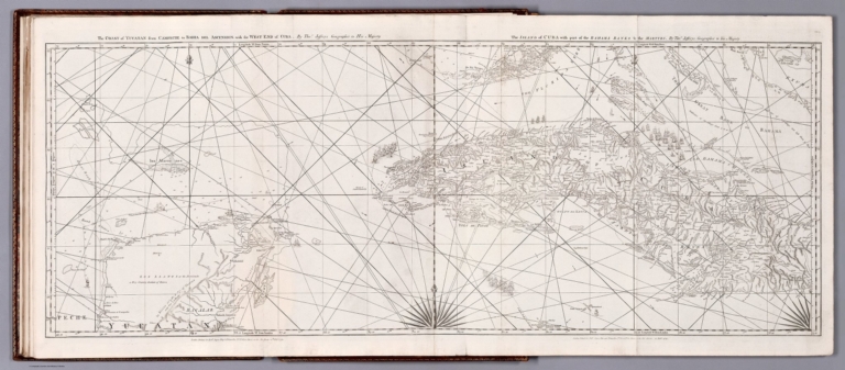
The coast of Yucatan from Campeche to Bahia del Ascension; with the west end of Cuba. By Thos. Jeffreys, Geographer to His Majesty. -- The Island of Cuba with part of Bahama Banks & the Martyrs. By Thos. Jeffreys, Geographer to His Majesty. London. Printed for Robt. Sayer, Map & Printseller, No. 53 in Fleet Street, as the Act directs 20th Feby. 1775.
List No
14471.046
Note
Nautical chart of the coast of Yucatan from Campeche Bay to Bahía de la Ascensión, as well as Cuba, in 1775. Shows cities, topography, vegetation, bodies of water, drainage, coastlines, ports, bays, anchorage, shoals, islands, rocks and depths, given in fathoms. Relief shown pictorially and with hachures. Includes rhumb lines, latitudinal and longitudinal lines, as well as compass roses with north oriented toward top of sheet. With descriptive notes throughout. Black and white copper-engraving. Chart is 45 x 120 cm, on fold-out plate 55 x 127 cm. Chart appears in second volume of atlas.
Author
Wright, Thomas
Full Title
A New Chart of the Gulf of St. Lawrence Compiled from the Original Drawings of Actual Surveys; following the Natural configurations of the Several Coast & Headlands; The whole adjusted by Astronomical Observations, by Thos. Wright Surveyor General of the Island St. John. NB. The Genuine Copies of this Chart, will have the Signature of the Proprietor.
List No
16140.000
Author
Mount and Davidson
Full Title
(Covers to) The English Pilot. Describing the West-India Navigation, from Hudson's Bay to the River Amazones. Particularly delineating the coasts, capes, headlands, rivers, bays, roads, havens, harbours, streights, rocks, sands, shoals, banks, depths of water, and anchorage, with all the islands therein ... also a new description of Newfoundland, New England, New York, east and west New Jersey, Dellawar Bay, Virginia, Maryland, Carolina, &c. shewing the courses and distances from one place to another; the ebbing and flowing of the sea, the setting of the tides and currents, &c. with many other things necessary to be known in navigation. The whole being much enlarged and corrected, with the additions of several new charts and descriptions. London: Mount and Davidson, M,DCC,XCIV.
List No
12434.001
Note
Quarter bound in light brown leather with pale green marbled paper covered boards. Spine with gilt rules, with text in the second compartment, "English Pilot".
Author
Halley, Edmund
Full Title
The New and Correct Chart of the Western and Southern Oceans.
List No
12434.002
Note
Foldout. This is a corrected edition of Edmund Halley's landmark 1701 chart with the same title. Peter Barbour hailed that chart as the "most significant cartographic achievement of Williamite England" (The Age of William III & Mary II, plate 106.) It was one of the earliest thematic maps, and the first to show lines of equal magnetic variation which was an important advance for navigation. A version of Halley's chart was added to the Fourth Book in 1721, but was discontinued in favor of this revised version in 1749. As noted in the flanking text, there is a "perpetual though slow Change in the Variation almost everywhere, which as made it necessary to construct [the chart] anew from accurate Observations, made by the most ingenious Navigators."
Author
Mount and Davidson
Full Title
(Title Page) The English Pilot. Describing the West-India Navigation, from Hudson's Bay to the River Amazones. Particularly delineating the coasts, capes, headlands, rivers, bays, roads, havens, harbours, streights, rocks, sands, shoals, banks, depths of water, and anchorage, with all the islands therein ... also a new description of Newfoundland, New England, New York, east and west New Jersey, Dellawar Bay, Virginia, Maryland, Carolina, &c. shewing the courses and distances from one place to another; the ebbing and flowing of the sea, the setting of the tides and currents, &c. with many other things necessary to be known in navigation. The whole being much enlarged and corrected, with the additions of several new charts and descriptions. London: Mount and Davidson, M,DCC,XCIV.
List No
12434.003
Author
Mount and Davidson
Full Title
(Text Page) The English Pilot, The Fourth Book.
List No
12434.004
Author
Mount and Davidson
Full Title
(Text Page) The English Pilot, The Fourth Book (continued). A Description of Hudson's Streights.
List No
12434.005
Author
Mount and Davidson
Full Title
A New and Correct Chart of the North Part of America from New Found Land to Hudsons Bay.
List No
12434.006
Author
Mount and Davidson
Full Title
A New Generall Chart for the West Indies of E. Wright's Projection.
List No
12434.007
Author
Mount and Davidson
Full Title
(Text Page) The English Pilot, The Fourth Book. A Description of Hudson's Streights (continued).
List No
12434.008
Author
Mount and Davidson
Full Title
(Text Page) The English Pilot, The Fourth Book. A Description of Hudson's Streights (continued).
List No
12434.009
Author
Mount and Davidson
Full Title
(Text Page) The English Pilot, The Fourth Book. A Description of Hudson's Streights (continued).
List No
12434.010
Author
Bowen, Emanuel
Full Title
A New and Accurate Chart of the vast Atlantic or Western Ocean.
List No
12434.011
Note
Foldout.
Author
Mount and Davidson
Full Title
(Text Page) The English Pilot, The Fourth Book (continued). (A Description of Newfoundland).
List No
12434.012
Author
Mount and Davidson
Full Title
(Text Page) The English Pilot, The Fourth Book. A Description of Newfoundland (continued).
List No
12434.013
Author
Mount and Davidson
Full Title
(Text Page) The English Pilot, The Fourth Book. A Description of Newfoundland (continued).
List No
12434.014
Author
Southack, Cyprian
Full Title
The Harbour of Casco Bay, and Islands Adjacent.
List No
12434.015
Author
Mount and Davidson
Full Title
(Text Page) The English Pilot, The Fourth Book. A Description of Newfoundland (continued).
List No
12434.016
Author
Mount and Davidson
Full Title
(Text Page) The English Pilot, The Fourth Book. A Description of Newfoundland (continued).
List No
12434.017
Author
Mount and Davidson
Full Title
(Text Page) The English Pilot, The Fourth Book. A Description of Hudson's Streights (continued).
List No
12434.018
Author
Mount and Davidson
Full Title
A New and Correct Chart of the Coast of New Foundland from Cape Raze to Cape Bonavista. (inset) Cheucto Harbour.
List No
12434.019
Note
Foldout.
Author
Mount and Davidson
Full Title
(Text Page) The English Pilot, The Fourth Book. A Description of Newfoundland (continued).
List No
12434.020
Author
Mount and Davidson
Full Title
(Text Page) The English Pilot, The Fourth Book. A Description of Newfoundland (continued).
List No
12434.021
Author
Mount and Davidson
Full Title
Island of St. Peters. (Text Page) The English Pilot, The Fourth Book. A Description of Newfoundland (continued).
List No
12434.022
Author
Mount and Davidson
Full Title
A Chart of the South-East Coast of Newfoundland.
List No
12434.023
Note
Foldout.
Author
Barnsley, Henry
Full Title
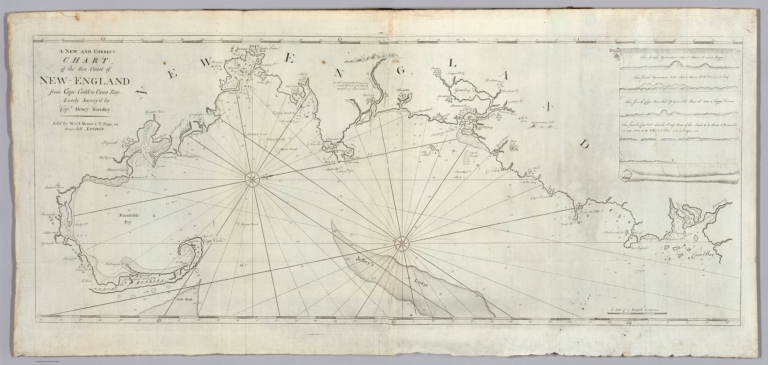
A New and Correct Chart of the Sea Coast of New-England from Cape Codd to Casco Bay.
List No
12434.024
Note
Foldout.
Author
Southack, Cyprian
Full Title
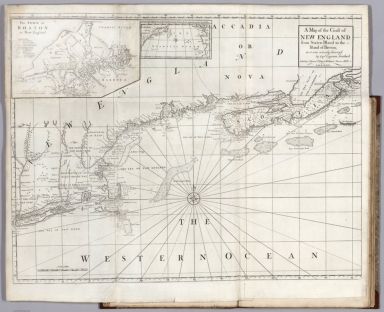
A Map of the Coast of New England, from Staten Island to the Island of Breton; as it was actually Survey'd by Capt. Cyprian Southack. (inset) Boston.
List No
12434.025
Note
Foldout. This is a reduction of the 8 sheet chart that made up The New England Coasting Pilot (London, 1729-34), by Southack, one of New England's most knowledgeable and experienced pilots.
Author
Mount and Davidson
Full Title
A Chart of New York Harbour with the Banks Soundings and Sailing marks from the most Accurate Surveys and Observations.
List No
12434.026
Note
A fine sea chart of New York Harbor which replaced Mark Tiddeman's outdated Draught of New York, which had appeared in early editions of this work since 1732.
Author
Mount and Davidson
Full Title
(Text Page) The English Pilot, The Fourth Book. Descriptions for sailing into several Ports in New-England.
List No
12434.027
Author
Mount and Davidson
Full Title
(Text Page) The English Pilot, The Fourth Book. A Description of Newfoundland (continued).
List No
12434.028
Author
Mount and Davidson
Full Title
(Text Page) The English Pilot, The Fourth Book. A Description of New England.
List No
12434.029
Author
Thornton, John
Full Title
Virginia, Maryland, Pennsilvania, East & West Jersey.
List No
12434.030
Note
Foldout. A classic chart of the Chesapeake Region, originally published in 1689. It is a close copy of Augustine Herrman's map. The delineation of Delaware Bay and New Jersey includes additional data, probably from the Holme map of Pennsylvania.
Author
Tiddeman, Mark
Full Title
A Draught of Virginia from the Capes to York River and to Kuiquotan or Hamton in James River.
List No
12434.031
Note
The first printed map to show Williamsburg.
Author
Mount and Davidson
Full Title
(Text Page) The English Pilot, The Fourth Book. A Description of Virginia and Maryland.
List No
12434.032
Author
Mount and Davidson
Full Title
(Text Page) The English Pilot, The Fourth Book. A Description of Virginia and Maryland (continued).
List No
12434.033
Author
Mount and Davidson
Full Title
Barbados. (Text) The English Pilot, The Fourth Book. A Description of Caribbee Islands.
List No
12434.034
Author
Norwood, Andrew
Full Title
A New Mapp of the Island of St. Christophers being an Actuall Survey taken by Mr. Andrew Norwood Surveyr. Genll. (insets) Guadeloupe. Martinique.
List No
12434.035
Author
Norwood, Andrew
Full Title
A New Mapp of the Island of St. Christophers being an Actuall Survey taken by Mr. Andrew Norwood Surveyr. Genll. (insets) Guadeloupe. Martinique.
List No
12434.035
|


